ALL-DAY WEEKEND
Sunday No. A2301-893-10659 Jan 01, 2023
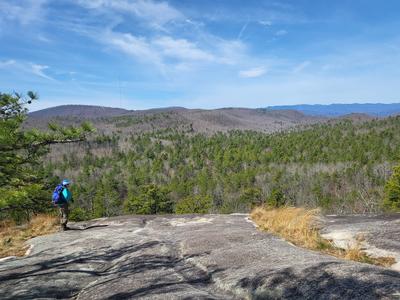
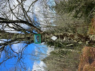
Green River Game Lands - West Side 9:15 AM
Hike 6.5, Drive 20, 1200 ft. ascent, Rated B-B,
Bruce Bente, 828-692-0116, cell 828-567-9443, bbente@bellsouth.net
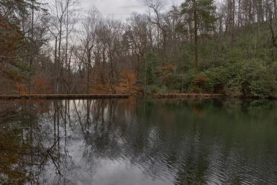
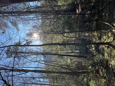
Only Meeting Place: Cracker Barrel Restaurant off Exit 53 of I-26 in parking lot close to I-26. Welcome to the 25th anniversary of the New Year's Day hike. Contact leader for reservation and include whether you will meet for breakfast before the hike. Driving distance from Asheville is 60 miles round trip. Join us for breakfast at Cracker Barrel at 8:00 AM or at 9:15 AM in the parking lot to leave for our traditional New Year's Day hike in the Green River Game Lands. This year's hike will follow the shorter route on the west side of the Game Lands but will still include lunch at the end of the Green River Cove Trail by the big rocks in the Green River.
Topo(s): Cliffield Mtn
hike report:
21 hikers appeared for this 25th anniversary of the New years Day hike. One left early and 20 completed all 9 miles of the hike. Nice warm weather for New years Day.Monday No. A2301-267-10625 Jan 02, 2023
Horsepasture River 9:00 AM
Hike 5.0, Drive 92, 1000 ft. ascent, Rated C-C, wc100
Judy Magura, 828-606-1490, quilter290@gmail.com and Jim Magura, 828-606-3989, jqs290@gmail.com
First Meeting Place: Asheville Outlets parking lot behind Waffle House off Exit 33 of I-26.
Second Meeting Place: Pisgah Forest Walmart parking (back of center aisles close to Taco Bell) at 9:30 AM - but contact leader first.
**This hike has been rescheduled to 1/2/23 due to weather.** Contact leaders for reservations. Come to see the Gorges State Park area in the winter. We will hike upstream alongside the Horsepasture River to see the waterfalls – Rainbow, Turtleback, Drift and Stairway. This hike is #13 of the 100 Favorite Trails.
Topo(s): Reid
hike report:
We had a great hiking day with 12 hikers on the Horsepasture River in Gorges State Park on a post New Years day. Pleasant temperatures in the 60's, full sun and an abundance of flowing water made for a great hiking adventure. We had postponed this hike three days due to rain in the area, but were rewarded with a rushing river and spectacular winter waterfalls. The trail was a bit muddy in spots, but was to be expected with the recent rainfall. Hike temperatures were in the low 60's which made for quite an enjoyable hike. When we did the scout earlier this summer many of the views were blocked with foliage, but winter views afforded a much better view of the river and a number of falls. Comfortable temperatures were also a plus for our January hike. We had a great mix of hikers, some old and some new joined us and really enriched our day. We encountered quite a few hikers on the trail also making a post New Years day of it as well.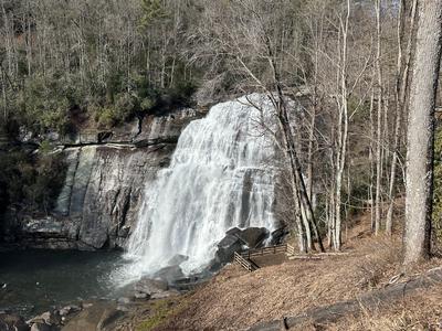
scout report:
Judy, Sharon and me scouted this hike in August and were able to complete it in its entirety. However, we did not linger at the turnaround point up river as they were blasting rock in the rock quarry above and we were escorted down by a safety guard from Drift Falls by the Park boundary to a safer spot on the river. We got some great stores from the guard while we waited for the blast which was quite loud and did shake the ground more than we expected. As an aside, this is #13 on the Favorite 100 Trails Challenge and a great one to check off. Given that we are hiking in late December we are hopeful for good weather in SC. Plan on viewing three falls on the hike: Rainbow Falls, Turtleback Falls and Drift Falls. Since we are hiking this in January, we will have better views of the falls which were partially obscured by foliage in the summer when we completed our scout hike.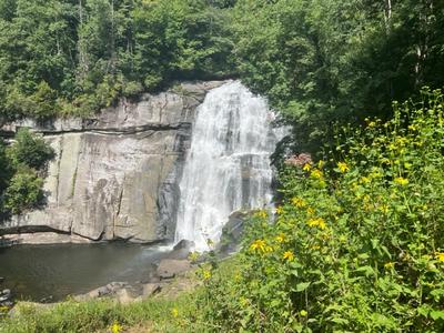
Sunday No. A2301-654-10704 Jan 08, 2023
Cantrell Creek - Squirrel Gap Loop 8:00 AM
Hike 13.0, Drive 36, 1800 ft. ascent, Rated AA-A, p400
Henry Kassell, 845-656-5528, hkassell@gmail.com
First Meeting Place: Asheville Outlets parking lot behind Waffle House off Exit 33 of I-26.
Second Meeting Place: Turkey Pen parking lot at 8:30 AM
Limit of 10 hikers. Email hike leader for reservation. This is a variation of hike #654. From the Turkey Pen trailhead we'll begin on the South Mills River Trail past the former site of the Cantrell Creek Lodge where we will continue onto the Cantrell Creek trail. We'll turn left on the Horse Cove Gap trail, then right onto Squirrel Gap. We'll follow this to Mullinax, turning right and return back to the Turkey Pen Gap parking. Possible wet stream crossings on Cantrell Creek Trail if there has been recent rain.
Topo(s): Pisgah Forest
scout report:
hike report:
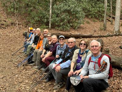
Today we hiked the Sunday hike. Why? Because rain was forecasted for tomorrow and the hike would not wait. FIve hikers joined me for this 13-mile 1825' elev. gain jaunt. This hike had it all. Under cloudy skies we covered all or portions of South Mills River Trail Cantrell Ck Trail Horse Cove Gap Trail Squirrel Gap Trail, and Mullinax. P400 people hit the jackpot and there was one "Hundred Fav." We had four stream crossings which had their challenges on Horse cove above Cantrell Lodge We were up for it! Fun and good cheer was abundant.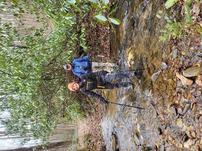
Saturday No. A2301-499-10690 Jan 14, 2023
New, Old and Future Greenways 10:00 AM
Hike 7.0, 100 ft. ascent, Rated B-C,
Marcia Bromberg, 828-505-0471, cell 860-798-9905, mwbromberg@yahoo.com
Only Meeting Place: Parking lot on Craven St. just north of New Belgium Brewery (west side of river). Contact hike leader via email for reservation. This hike follows current and future greenways along Hominy Creek and the French Broad River. We'll hike from the historic Sulphur Springs on dirt paths (may be muddy in spots) and pavement. On the way you'll learn about plans for a county-wide greenway system. Our walk will include the newest greenway between the French Broad River Park and New Belgium Brewery. For those who are interested, we'll end with a beer at the New Belgium Liquid Center. Car shuttle.
Topo(s): Asheville
Sunday No. A2301-892-10680 Jan 15, 2023
MST Winter Hike - NC 191 to Folk Art Center 9:00 AM
Hike 14.0, 2050 ft. ascent, Rated AA-AA, at-mst
Les Love, 828-230-1861, lesrlove55@gmail.com and Catherine/Mrs Les Love, 828-658-1489, catmlove2@gmail.com
Only Meeting Place: Back parking lot of Folk Art Center. Contact leader for reservation. This is a great winter workout hike on the MST through the Asheville corridor that everyone has had so much fun doing in previous years. We will begin at the French Broad Overlook near the NC Arboretum, hike over the rolling Biltmore section of the MST and end at the Folk Art Center. It will be a chance to view and experience all the tremendous work the Section Rovers Trail Crew has been doing on almost all of these sections. There will be a much-anticipated stop along the way for lunch and warmup at the Fresh Market. Car shuttle.
Topo(s): Asheville
hike report:
We had a chilly start at 24 degrees with 16 eager hikers warming up quickly as we set a good pace. Sunshine and no snow on the ground to start made for a lovely day. For lunch we had the Fresh Market dining area to ourselves and warm bathrooms -- an extravagance! Fourteen miles were completed, arriving at the Folk Art Center before 4 pm with smiles on our faces.Sunday No. A2301-1-10658 (canceled) Jan 22, 2023
Case Camp - Seniard Ridge Loop 9:00 AM
Hike 9.8, Drive 80, 1800 ft. ascent, Rated A-A, p400,wc100
Paul Benson, 828-273-2098, PDBenson@charter.net
First Meeting Place: Asheville Outlets parking lot behind Waffle House off Exit 33 of I-26.
Second Meeting Place: Pisgah Forest Walmart parking (back of center aisles close to Taco Bell) at 9:30 AM
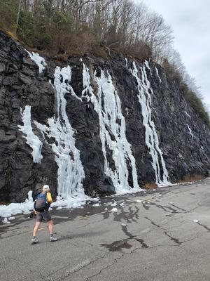
Form carpools and meet leader at second meeting place. This loop hike is scheduled for our coldest month to see 50-ft. frozen cascades along the closed Blue Ridge Parkway. We'll do a two-mile climb up to the MST and some gentle MST hiking before our lunch spot with great views of the mountains. After lunch, we'll hike downhill through beautiful woods on the Seniard Ridge Trail. We will pass two nice waterfalls along an old logging road. If Forest Road 475B is closed, we will have to walk to and from the trailhead, adding 1.7 miles to the hike. **Hike canceled due to rain forecast.**
Topo(s): Shining Rock
scout report:
Mel and I scouted today with warm, dry weather. Since the Parkway was closed we were able to walk on it rather than using the MST. Using this route we hiked 8.6 miles with 1,700' of elevation gain, in 4 hours 30 minutes. Trail conditions were generally good with no issues, except one large tree down next to the crossing of Big Bearpen Branch. Unfortunately, with the recent warm weather the highlight ice formations were not nearly as good as last year (see comparison pictures) but we did enjoy watching them melt into ice falls as we ate lunch.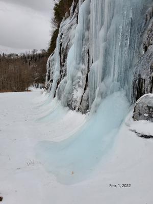
Saturday No. A2301-962-10700 Jan 28, 2023
Eastatoe Passage and Raven Rock Trail 9:00 AM
Hike 7.8, Drive 130, 1800 ft. ascent, Rated B-A,
Norm Sharp, 864-268-9409, cell 864-609-7182, norm.Sharp@att.net
First Meeting Place: Asheville Outlets parking lot behind Waffle House off Exit 33 of I-26.
Second Meeting Place: Holly Springs Country Store at SC 11/US 178 intersection at 10:15 AM
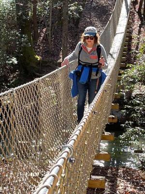
Limit of 15 hikers. Contact leader for reservation. Form carpools and meet leader at second meeting place. You must be fully vaccinated against COVID-19 to carpool. After meeting at 2nd meeting place, we will drive 6.3 miles to the trailhead on Roy Jones Road off SC 11, then shuttle vehicles 5.2 miles to Keowee-Toxaway State Park. We will hike the 4.6-mile Palmetto Trail to the state park's Jocassee Gorges Visitor Center and will cross two suspension bridges that were rebuilt in late 2020 due to flooding damage. Along the way we will hike the three-mile Raven Rock Trail loop in the State Park. The loop will take us to the scenic shores of Lake Keowee and a rock known as Party Rock, with a great view to the west. Car shuttle.
scout report:
Eastatoe Passage Scout Hike I scouted this shuttle hike over two days. I plan to start the hike at Keowee Toxaway State Park(no entrance fee) for a better lunch spot right by the lake, as well as less elevation gain. The informative Jocassee Gorges Visitor Center is at the hike start and is open from 11-12 AM and 4-5 PM. We will hike the Raven Rock trail loop to scenic Lake Keowee and eat lunch at the primitive campsites there or at a nearby lake overlook. Then we will continue on the Palmetto Trail to the trail end, along Eastatoe Creek and crossing two unique suspension bridges, rebuilt after flooding destroyed the prior bridges. The shuttle will be less than 10 miles.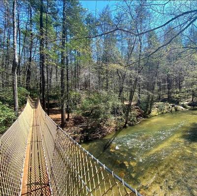
Sunday No. A2301-349-10679 Jan 29, 2023
Buck Spring Trail to Pisgah Inn 8:00 AM
Hike 12.0, Drive 44, 1200 ft. ascent, Rated A-B, at-mst, p400
Donna Lanning, 828-606-7956, dblanning@bellsouth.net
First Meeting Place: Asheville Outlets parking lot behind Waffle House off Exit 33 of I-26.
Second Meeting Place: Pisgah Forest Walmart parking (back of center aisles close to Taco Bell) at 8:30 AM
Form carpools at the first meeting place and meet leader at the second meeting place. This lovely hike gradually switchbacks up the mountain with a stronger grade at the finale. There are several easy creek crossings. We will have lunch behind the Pisgah Inn to enjoy the winter views. After lunch, we will hike back downhill to our cars.
Topo(s): Cruso,Shining Rock
scout report:
This is a nice winter hike. The trail wanders around and about the mountains so that we’re seeing different views. It’s a fairly level trail and includes ~10 water crossings one way. When I scouted it, the water was running pretty well but I didn’t get my shoes wet except on the bottom. The climb is left until we’re going up to the turnaround and lunch spot at Pisgah Inn. I hope the weather is nice, however this winter who knows? Keep an eye on breaking news for updates if the weather looks questionable. Donna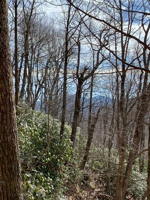
hike report:
Eight hikers joined me on a mostly cloudy, cool day. Rain was expected at 4:00 and in our last mile it did lightly shower, we were happy to avoid more. However, we did have a brief sleet shower on the way up! The group was friendly and amiable…thankful for the opportunity for a good workout when there had been a potential for a rainout. Despite cloudy skies, the views at Pisgah were amazing as always, the clouds were still high so there was no fog or breeze. Thank you hikers for a fun day! Donna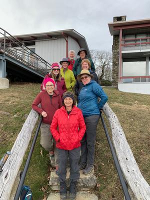
Saturday No. A2301-280-10656 Feb 04, 2023
North Slope and Art Loeb Trails 9:00 AM
Hike 7.5, Drive 62, 1600 ft. ascent, Rated B-A, p400
Thomas Butler, 361-484-3381, butler.tom3381@gmail.com
First Meeting Place: Asheville Outlets parking lot behind Waffle House off Exit 33 of I-26.
Second Meeting Place: Pisgah Forest Walmart parking (back of center aisles close to Taco Bell) at 9:30 AM
Contact leader via email for reservation. Form carpools and meet leader at second meeting place. We start at the Davidson River Campground and ascend on the Art Loeb Trail to the North Slope Connector. We'll eat lunch at the intersection before we start down the connector to the North Slope Trail, ending with a lovely, easy stroll along the river to the cars.
Topo(s): Pisgah Forest
scout report:
5 of us scouted this 7.5 mile loop hike that begins in the Davidson River Campground. hiked in a clockwise direction starting on the Art Loeb trail, which begins to climb and continues to do so for about 3 miles. Near the 4 mile point Art Loeb intersects with the North Slope Connector very sharply to the right. Keep an eye out or you will miss the turn (we did!). At one point there was double blazing to alert you, but one of the blazes is now very faint. An improvement would be to relocate the Forest Service trail marker to be visible to hikers on the Art Loeb. Currently, you see it on the connector, after you have turned. The hike descends to the North Slope loop where we chose to go left. Continue to follow the North Slope signs to the campground and back to the cars.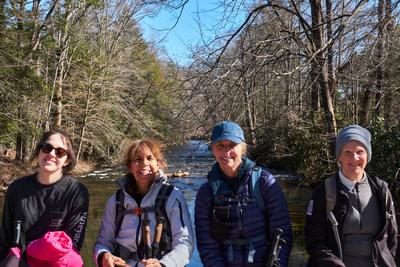
Sunday No. A2301-930-10660 Feb 05, 2023
Upper Weed Patch Mountain 8:00 AM
Hike 10.3, Drive 56, 1995 ft. ascent, Rated A-A,
Marie Chamberlin, 678-492-6718, marie.m.chamberlin@gmail.com
Only Meeting Place: Ingles on US 74-A 225 Charlotte Hwy (Reynolds). Contact leader for reservation. Limit of 10 hikers. This out-and-back hike begins in Chimney Rock State Park with a short section on a service road and then goes on to a trail up to Eagle Rock for a great view. We then continue on Weed Patch Mountain Trail with a short side trip to Tunnel Rock. Returning to Weed Patch Mountain Trail, we continue on to Flapjack Rock and finish at Grey Rock for a lunch break and to enjoy views of Lake Lure, Rumbling Bald and Eagle Rock. To return to our cars, we retrace our steps. NOTE: There is about 1/10 mile travel on a gravel road to get to the trailhead; high-clearance vehicles are required (i.e. sedans not recommended). Carpooling recommended due to small parking area.
hike report:
Our hike began with freezing temperatures and cloudy skies but eventually warmed to low 50's. We stopped briefly to enjoy the view at Eagle Rock, then proceeded downhill to the turnoff for Tunnel Rock for a water break and more views. Then back to the trail to Flapjack Rock where we snacked and rested and then began the mostly uphill climb to Grey Rock, our lunch stop and turn-around point. It was quite windy and cold on Grey Rock, but we did enjoy the far away views of Lake Lure. After passing Flapjack Rock on the return, the trail became quite muddy, as the frozen earth had thawed with the warming temperatures. So we had to step carefully to avoid slipping on the mud! Another stop at Eagle Rock where several climbed to the top. We encountered four mountain bikers today, but very few hikers until we neared Eagle Rock. The parking lot was entirely full when we returned to our cars shortly before 3:00.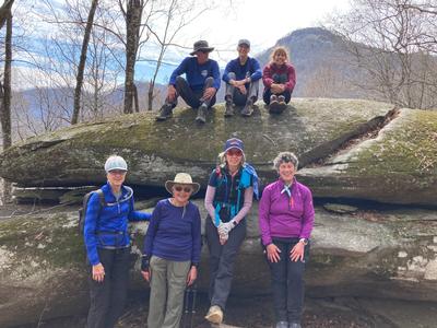
scout report:
I scouted this hike on Dec. 12. Thank you to Lorrie M. for scouting it with me. She hiked this with the CMC meetup group in October. The hike has only been led one time as a CMC hike, and it is a hidden gem! From the parking area there is a gentle climb of only 4/10 mile to reach the first outcropping, Eagle Rock. Some people can see the profile of an eagle in the rocks. In less than another downhill mile we reached Tunnel Rock, which is a short distance off the main trail. The tunnel is really two very tall rocks that the trail goes between. Flapjack Rock is beside the trail at about 2.6 total miles, and is a good spot for a snack break. Another 1.7 miles takes us to Grey Rock, the lunch spot and turn-around point of the hike. On a clear day there are views of Lake Lure from here. This trail is practically devoid of fallen leaves on the trail. To the point where I wondered if trail maintainers swept the leaves off the trail. The trail meanders up and down but is never very steep. The first 1 1/2 miles is in Chimney Rock State Park (bicycles are allowed on this section, although we did not see any, only tracks), then enters Buffalo Creek Park, part of the town of Lake Lure. Some sections have large flat rocks to walk across which can be slick if wet. We saw no other hikers on the trail. The parking lot can hold about 10 vehicles, but if it is full there is no other area to park, as the surrounding properties all have “Do not park” signs in front of them. The dirt road to the parking lot is less than 2/10 mile long, and although sedans are not recommended, a high clearance vehicle will not have a problem. It is about a 40 minute drive from the Ingles on 74-A which is the meeting point.
Saturday No. A2301-534-10662 Feb 11, 2023
Turkey Pen, Pounding Mill, Mullinax Loop 10:00 AM
Hike 7.0, Drive 50, 1200 ft. ascent, Rated B-B, p400
Bruce Bente, 828-692-0116, cell 828-567-9443, bbente@bellsouth.net
First Meeting Place: Asheville Outlets parking lot behind Waffle House off Exit 33 of I-26.
Second Meeting Place: Turkey Pen parking lot at 10:30 AM
Contact hike leader for reservation. Form carpools and meet leader at second meeting place. This is a nice winter hike, low elevation and close to Asheville. We’ll follow an interesting manway to the S. Mills River footbridge, then do a loop on the scenic Pounding Mill and Mullinax Trails. It is recommended that only high clearance vehicles make the drive on Turkey Pen Rd.
Topo(s): Pisgah Forest
hike report:
We had six hikers on a cloudy day in the high 40s. Began the hike at 10:30am and finished at 3:00pm. Lunch was at the top of Pounding Mill Trail, comfortably sitting on a log that is located in a perfect location. Pounding Mill Trail needs maintenance due to fallen trees, including one big one that fell in the middle of the creek and was tricky to climb over and avoid the water.Sunday No. A2301-290-10691 (canceled) Feb 12, 2023
MST/Shut-in Trail through Bent Creek and Arboretum 9:30 AM
Hike 7.5, Drive 10, 1000 ft. ascent, Rated B-C, at-mst
Karen Lachow, 703-395-5879, heyk127@hotmail.com
First Meeting Place: Asheville Outlets parking lot behind Waffle House off Exit 33 of I-26.
Second Meeting Place: Bent Creek River Park off NC 191 at 9:45 AM
**CANCELLED due to winter storm warnings** Limit of 15 hikers. Contact leader via email for reservation. This hike starts on the Shut-in Trail, a section of the MST paralleling the Blue Ridge Parkway with winter views of the French Broad River and some distant mountains. We will turn off onto Hard Times Trail into Bent Creek Forest, taking the Rocky Cove Trail into the NC Arboretum on the Bent Creek Trail where we can wander in and out of the Creekside Trails. Next, we’ll take the Carolina Mountain Trail to a lovely spot next to the creek for lunch. We will continue through the gardens, make a stop at the Education Center, then take the Wesley Branch Trail down to the gatehouse and back to our cars.
Topo(s): Asheville
scout report:
I scouted this on Jan. 7 with Daisy K. It is 7.5-miles with just under 1000 ft. ascent. Since I have a membership, we parked in the lower lot of the NC Arboretum. The loop starts on the MST/Shut-in trail near the entrance. This 2.5-mile section comprises most of the elevation gain and will give you a good workout. We were pleased to come upon a section recently worked on by the awesome CMC maintenance crews with newly installed steps and water diversions. We turned into Bent Creek, then Rocky Cove an enjoyable mostly level trail which goes into the Arboretum. We stopped for lunch at one of my favorite spots along the creek on the Carolina Mountain Trail which we will do, weather permitting. Up in the Arboretum, we stopped at the restrooms in the education center and found the Bistro is closed until March. So, no hot drinks but a chance to warm up if needed. We continued through the gardens with remnants of the Winter Lights Festival and onto the Wesley Branch trail. It was nice to see the car when we reached the bottom lot. We may do that the day of the hike if enough people have passes.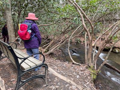
Saturday No. A2301-550-10673 Feb 18, 2023
Paris Mountain 8:00 AM
Hike 8.7, Drive 130, 2000 ft. ascent, Rated B-AA,
Thomas Butler, 361-484-3381, butler.tom3381@gmail.com
First Meeting Place: Asheville Outlets parking lot behind Waffle House off Exit 33 of I-26.
Second Meeting Place: Cracker Barrel Restaurant off Exit 53 of I-26 in parking lot close to I-26 at 8:30 AM
Contact leader for reservation. Located between Traveler’s Rest and Greenville, Paris Mountain State Park is one of the oldest protected areas in South Carolina. Originally, the lakes were the source of Greenville’s water supply. We will walk on well-maintained trails, enjoying good winter views and warmer weather than in Asheville. We will cross the road at shelters #5-6 and take Sulphur Springs Trail to Brissy Ridge Trail, Pipsissewa Trail, North Lake Trail (lunch on lakeshore), Kanuga Trail, Fire Tower Trail, an in-and-out to remains of fire tower attendant's house, Sulphur Springs Trail to Mountain Lake and continue on Sulphur Springs Trail back to trailhead. $6/person entrance fee.
Topo(s): Paris Mtn
hike report:
Great hike under sunny skies with mild temps. Seven of us hiked multiple trails to form a counterclockwise loop of 8.2 miles. This a great hike for its diversity of views: winter views, two different lake views, views of artifacts from a former fire tower, and views of a pretty stream to end the hike.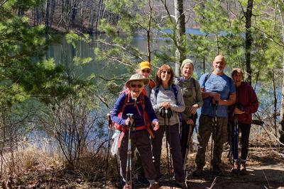
scout report:
Karen, Ken and I scouted this hike on 2-11, an overcast day, but otherwise good weather. We hiked a loop made of several trails, counterclockwise, beginning with the Sulphur Springs trail across from shelters 5 and 6. Best map for the hike can be found on the Paris Mountain State Park website. While most of the trail is in great shape and not difficult, the section from North Lake to the fire tower is a bit steep, and the final descent to the cars is steep and rocky. We saw lots of other hikers enjoying the day. Overall a great hike, with lake views, hiking along a picturesque stream, and interesting artifacts at the site of the old fire tower.
Sunday No. A2301-600-10675 Feb 19, 2023
Pink Beds - Buckhorn Gap - South Mills River Loop 8:00 AM
Hike 13.1, Drive 75, 1000 ft. ascent, Rated AA-C, p400
Kathy Cornn/Kyle, 828-458-1282, katherinenkyle@gmail.com and Michael Cornn, 828-458-1281, mwcornn@gmail.com
First Meeting Place: Asheville Outlets parking lot behind Waffle House off Exit 33 of I-26.
Second Meeting Place: Pisgah Forest Walmart parking (back of center aisles close to Taco Bell) at 8:30 AM
We’ll start on the Pink Beds Loop to Barnett Branch, up to Buckhorn Gap, down to the South Mills River, then hike to gauging station and return to our cars back through the Pink Beds Loop Trail. Lots of variety and a moderate pace.
Topo(s): Shining Rock
scout report:
It's a good thing we scouted this hike. There is a fork in the trail after about 1.5 miles and we took the left when we should have taken a right. There was no trail sign. The "no name trail" was actually a good trail and it looped around and connected with the second half of our hike. We hiked the rest of the trail in reverse to clarify what happened. We will eat at the shelter and we did see several mountain bike riders while hiking. The no name trail might be a good alternative hike in the future.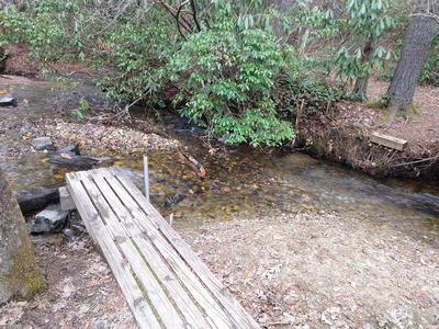
hike report:
Five of us hiked on a perfect weather day. The hike offered a variety of views and followed several streams including South Mills River. We met bike riders and two fishermen. Recent rains made the water crossings wet ones. Cindy, however, was able to make each crossing without getting wet. Repair work to what are now bridge skeletons is needed.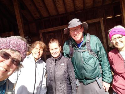
Sunday No. A2301-592-10665 Feb 26, 2023
Butter Gap - Long Branch Loop 8:30 AM
Hike 10.6, Drive 70, 1780 ft. ascent, Rated A-A, p400,wc100
Kay Haskell, 610-613-4858, HaskellKM@Gmail.com
First Meeting Place: Asheville Outlets parking lot behind Waffle House off Exit 33 of I-26.
Second Meeting Place: Pisgah Forest Walmart parking (back of center aisles close to Taco Bell) at 9:00 AM
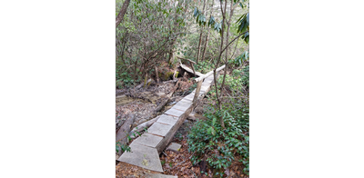
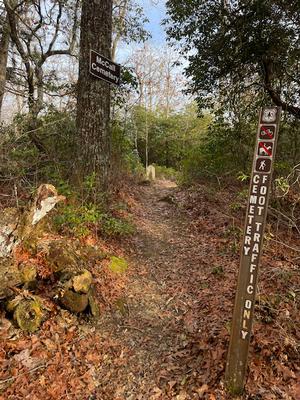
Limit of 10 hikers; all must be vaccinated. Contact leader for reservation. This hike will start at Gloucester Gap and follow the Art Loeb Trail over Chestnut Mtn. to Butter Gap. At the gap, we’ll turn downhill onto the Butter Gap Trail, then the Long Branch Trail and Cemetery Loop past the McCall Cemetery. There will be a short side trip to a beautiful, but rarely visited waterfall. We’ll finish with a road walk back to the trailhead. This hike is #58 of the 100 Favorite Trails.
Topo(s): Shining Rock
scout report:
In August 2011,Tropical Storm Fred, created a great deal of damage in western NC. One of the FS access road to the Gloucester Trailhead is still not operational as of February 2023. When I scouted this route, the route to the trailhead was Cathey’s Creek Road. The drive time from Brevard Walmart meeting point is about 45 minutes to the trailhead--so factor that into your hike planning. Trailhead parking is limited. The Butter Gap Trail is a popular mountain bike destination and connects here. Karen L and I hiked at a very leisurely pace the 10.55 miles and viewed both the Long Branch Falls and the McCall Cemetery so that the hike would qualify as #58 for the Favorite 100 Hikes. The elevation gain of 1,762 miles is compiled over the course of the entire loop. There are several sections of this hike that are always muddy, a few rock hop water crossings, and erosion caused by mountain biking. When we hiked through were several downed trees, but they were easy to clamber over. Hiking poles are strongly recommended. In mid February, we often had beautiful views through the deciduous trees of the mountains on both sides of the trails. Towards the end of the hike,Long Branch opens onto FS 475 and it’s rocky road uphill to the parked cars.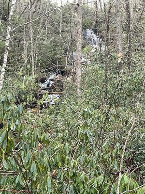
hike report:
The starting point for the loop, Gloucester Trailhead can be accessed by following Catheys Creek Road off of RT64 W. This is a long and windy dirt road so factor this into your hike planning. A group of 13 of us had an enjoyable hike that started with slight showers and temperatures around 46 degrees. After 10.3 miles, we ended the hike with sunshine and temperatures in the mid 60s. This loop still has several large trees that need to be climbed over and several areas where the trail is eroded which make hiking poles useful. The views of fog hanging in the valleys was visible on both sides of the Art Loeb section--spectacular, and we all appreciated the power and sound of Grogan Falls. On the downside, this hike was interrupted when one of hikers discovered that her cellphone had fallen out of an unsecured pocket. The phone was found, but the cell phone owner and accompanying hiker took over an hour and half to return to the group. Our hiking group would remind everyone to make certain that his/her personal items secured before setting down the trailTuesday No. Y2301-911-4592 (canceled) Feb 28, 2023
No hike scheduled this is for testing only 9:00 AM
1 ft. ascent, Rated C-C, at-mst, wc100 Judy Magura, 828-606-1490, quilter290@gmail.com
Only Meeting Place: Trailhead (end of Fisher Creek Rd.). This is a Test Hike to validate procedure.
Sunday No. A2301-478-10664 (canceled) Mar 05, 2023
Graveyard Fields Loop with Upper Falls 8:30 AM
Hike 7.0, Drive 70, 900 ft. ascent, Rated B-C, at-mst, p400,wc100
Karen Schultz, 312-241-3329, schultz.karenj@gmail.com and Ken Scharmann, 847-772-4693, kennethscharmann@gmail.com
First Meeting Place: Asheville Outlets parking lot behind Waffle House off Exit 33 of I-26.
Second Meeting Place: BRP Cold Mountain Overlook at MM 412 at 9:00 AM
*Canceled due to BRP closure. See Substitute hike.* Limit of 10 hikers. t be fully vaccinated against COVID-19 to carpool. Contact Karen Schultz via email for reservation. We will follow the loop clockwise, beginning on the blue blaze trail to the MST Connector Trail, then follow the MST to the Graveyard Ridge Trail which we will take back to the MST. When we return to where the MST meets Graveyard Ridge, we'll take the spur in the opposite direction and continue up the Graveyard Upper Falls Trail to enjoy the falls. This hike exceeds the requirements for #52 of the 100 Favorite Trails. Mus
Topo(s): Shining Rock
hike report:
Hike Canceledscout report:
Sunday No. A2301-182-11772 Mar 05, 2023
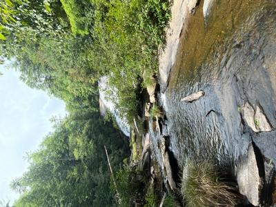
Green River Cove Trail 8:30 AM
Hike 7.0, Drive 75, 1400 ft. ascent, Rated B-B,
Karen Schultz, 312-241-3329, schultz.karenj@gmail.com and Ken Scharmann, 847-772-4693, kennethscharmann@gmail.com
First Meeting Place: Asheville Outlets parking lot behind Waffle House off Exit 33 of I-26.
Second Meeting Place: Cracker Barrel Restaurant off Exit 53 of I-26 in parking lot close to I-26 at 9:00 AM
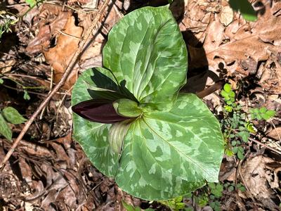
Contact Karen Schultz for reservation; limit of 10 hikers; must be fully vaccinated against COVID-19 to carpool. Hike the Green River Cove Trail from the bridge to its end at the big rocks on the Green River where we will have lunch and then return on the same trail. The upper end of the hike is near the bottom of the "Narrows" section of the gorge that kayakers like to run. Expect a few early wildflowers and maybe even kayakers on the river. This hike meets and exceeds the requirements of #72 of the 100 Favorite Trails.
Topo(s): Cliffield Mtn,Cliffield Mtn
scout report:
Scout Report: We had not done this trail before and wanted to experience the beauty of the river on a glorious December day! We were greeted by a fine mist coming up from the river, whenever the sun peeked from behind the mountains. The trail was a bit muddy and the water crossings were high due to several days of heavy rain in a row. All of the terrain was navigable with waterproof shoes and hiking poles. We started the hike at 9:15 and finished the 6.65 mile trail in 4:18 hours. This included a couple of trail breaks and a lunch stop at the rocks on the river at end of the trail. We were not surprised to pass fellow CMC members out enjoying this fabulous trail! We were also not surprised to see a couple of kayakers navigating the river as the day warmed up! We hope to have wild flowers in bloom when we lead this hike in March! Parking is somewhat limited, so carpooling is advised.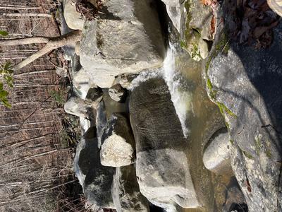
hike report:
10 hikers enjoyed a beautiful sunny day hiking the Green River Cove Trail. We encountered many wildflowers along the way and spotted a couple of kayakers as we finished lunch on the rocks. It was a lovely day and a wonderful group of hikers!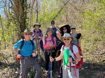
Saturday No. A2301-525-10693 Mar 11, 2023
Corn Mill Shoals P.L. #2 - Cedar Rock 10:00 AM
Hike 5.0, Drive 60, 400 ft. ascent, Rated C-C, wc100
Henry Kassell, 845-656-5528, hkassell@gmail.com
First Meeting Place: Asheville Outlets parking lot behind Waffle House off Exit 33 of I-26.
Second Meeting Place: Pisgah Forest Walmart parking (back of center aisles close to Taco Bell) at 10:30 AM
Contact hike leader via email for reservation. A pleasant hike over several trails up and over the granite slabs of Big Rock and Cedar Rock. From Corn Mill Shoals parking lot we will take Big Rock Trail and Cedar Trails to Little River Trail. We will snack at the river and return on Corn Mill Shoals Trail.
Topo(s): Standingstone Mtn
hike report:
Eleven hikers showed up today. We hiked all or portions of several trails including High Rock, Cedar Rock, Little River, and Corn Mill Shoals trails. The already short hike was shortened further by the closure of the access to the upper part of Bridle Veil falls. We then added a loop on the Burnt Mt Trail which turned out to be the highlight of the day. Not every hike in Dupont needs a waterfall. It was too early for wildflowers but mountain bikers were abundant. We finished the day with 6.5 miles under our packs!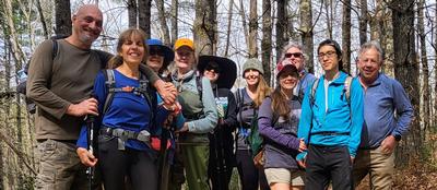
Sunday No. A2301-558-10687 Mar 12, 2023
A.T. from Hot Springs to Tanyard Gap to Round Top Ridge Trail 8:30 AM
Hike 10.0, Drive 70, 3000 ft. ascent, Rated A-AA, at-mst
Tish Desjardins, 828-380-1452, desraylet@aol.com
First Meeting Place: 160 Zillicoa St. (USFS parking lot) off Exit 25 of I-26.
Second Meeting Place: Corner of US 25/70 & NC 208 at 9:15 AM
Note: First day of DST. Form carpools and meet leader at second meeting place. We will begin by ascending the A.T. at Hot Springs, past Lovers Leap Ridge and Pump Gap all the way to Tanyard Gap. We will continue climbing on the A.T. northbound until reaching the Round Top Ridge trail where we will then descend back down to the river and into Hot Springs.
Topo(s): Hot Springs
Sunday No. A2301-868-10661 (canceled) Mar 19, 2023
Woodfin Cascades to Waterrock Knob 8:00 AM
Hike 11.4, Drive 65, 2300 ft. ascent, Rated A-AA, at-mst, sb6k
Lorraine Bernhardt, 828-699-8857, lsbernhardt50@gmail.com
Only Meeting Place: Home Depot off Exit 44 of I-40. *Canceled due to BRP being closed.* This variation of Hike #868 starts from the Woodfin Cascades Overlook on the Blue Ridge Parkway. We will hike on the MST for 4.8 miles and then take the fairly steep path just above the visitor center to Waterrock Knob for great views. We return via the same route. This hike features an evenly graded trail through various forest types. This hike is #38 of the 100 Favorite Trails.
Topo(s): Hazelwood,Sylva North
scout report:
It was a beautiful day! Sun, no clouds and breezy. I was really looking forward to this scout hike, anticipating the long range views. Even checked the parkway closures earlier in the week but no worries, warm temperatures. So made that turn onto the parkway and the gate is closed. Whaaaaa? Ok, time to regroup. I knew there was another road that would get us to the parkway, just a little narrow, steep and windy. So it would take a little longer, no big deal. I’m carefully watching my google maps as we drive, only about 5 minutes to go. There is a big gate with a camera and threatening signs. Whaaaa? Private road, really? Google maps, you let me down! Now where to hike? After discussing options, we decided to just get on the MST somewhere, not going to waste this day! Rosie is getting restless (Donna’s dog) and something needs to happen quick. Stopped at an overlook just a few feet from our side road but no access to park. Walked around and decided to return to the parkway entrance, and access the MST from there. Walked past the gate and then we saw the reason for the closure…..a large tree blocking the road. So got on the MST and enjoyed an in and out hike to no defined point. Still pretty views and a lovely day. I did scout this hike last fall so all is good. The lesson learned is 1). Check for parkway closures, not just temperature related but also after a storm 2). Keep All Trails and Google maps close by but realize they are not perfect tools 3). Scout with a patient friend, thank you Donna! Please check breaking news before the hike and I will check for closures and update if anything changes :).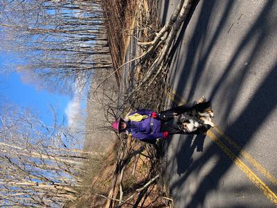
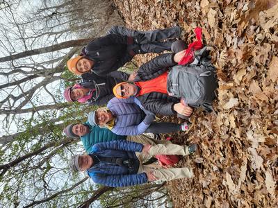
Saturday No. A2301-428-10681 Mar 25, 2023
Cane River Gap to Little Butt 8:15 AM
Hike 7.5, Drive 52, 2200 ft. ascent, Rated B-AA,
Judy Magura, 828-606-1490, quilter290@gmail.com and Jim Magura, 828-606-3989, jqs290@gmail.com
First Meeting Place: 160 Zillicoa St. (USFS parking lot) off Exit 25 of I-26.
Second Meeting Place: Publix at 165 Weaver Blvd. Weaverville; lower end of parking lot off Exit 19 of I-26 at 8:30 AM
Contact leader for reservation. This hike begins with a significant 1200-ft. ascent to the ridgeline, then continues along the top of the ridge with a few gradual ups-and-downs. After Big Butt, we’ll follow the narrow ridgeline with good views to our lunch spot at Little Butt which has a great view of the Black Mountains across the valley. Return via the same route.
Topo(s): Mt. Mitchell
scout report:
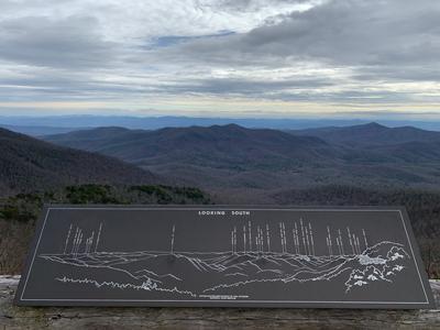
Judy and I scouted this trail earlier this winter as an in and out. This hike takes you up and around Big Butt from the North via Flat Springs Knob. There is a big climb at the beginning of this hike and we will take a number of breaks on the ascent. We will continue on the trail around Big Butt and follow the ridge to Little butt for a lunch break at our usual view point on the ledge. Many of you have gone up to Big Butt from the South will recognize the side trail up to the Top of Big Butt. If weather is great, you will have a fantastic view of the Blacks and a significant number of 6K peaks during our lunch break. You will find the second half of the hike back down to our car to be significantly easier. Please note the ascent on this hike is difficult and a challenge.
hike report:
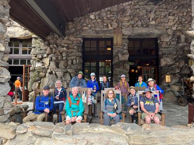
As a result of a rain delay, we got off to a late start with 14 hikers at 11:00 am with a steep climb up 2200 feet up to the side trail leading to Big Butte. We continued from this trail junction back down along the narrow ridge line leading to Little Butte our destination. Fortunately for us hiking conditions were excellent and despite the late start we made good progress in the morning. We arrived at our lunch spot at 12:45 and had a good break with great views of the Black Crest Trail. The group photo at the lunch spot was missing three hikers (Judy, Lorri & Carrie) who were unfortunately in the background (my bad). The second photo was of the 6k Black Crest Trail peaks across the valley. I did note the rhododendron along the ridge line down from Big Butte had grown considerably blocking the views both east and west. When we started hiking 13 years ago with CMC we had exceptional views on both sides of this very narrow ridge line.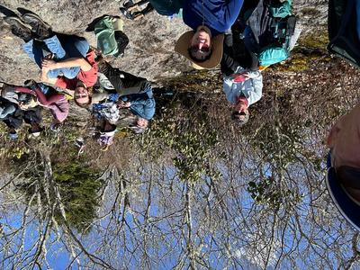
Sunday No. A2301-909-10686 Mar 26, 2023
Asheville Camino del Norte Walk 9:00 AM
Hike 10.0, 500 ft. ascent, Rated A-C,
Danny Bernstein, 828-450-0747, dannyhiker@gmail.com
Only Meeting Place: Montford North Star Academy 90 Montford Ave. Asheville. Meeting place is next door to the Asheville Visitor Center. PLEASE do not park at the Visitor Center. Contact leader by email for reservation. Walk the Asheville Camino del Norte, a 10-mile easy walk on sidewalks and trails. See North Asheville, University of North Carolina at Asheville and the Botanical Gardens. Have a café con leche at the historic Grove Park Inn. The hike simulates a short day on the Camino. Wear good sneakers or low boots. Bring water, snacks and lunch. We'll stop for morning coffee, but feel free to bring all your own food.
scout report:
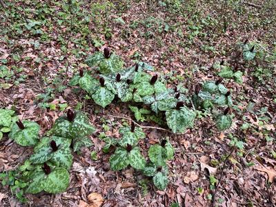
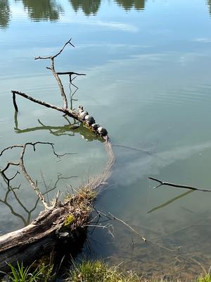
I love this walk through the North part of Asheville, It is not all on pavement. It has plenty of natural surface where I saw spring flowers, bluebirds and even turtles. When I scouted it, UNCA was buzzing, Beaver Lake was sunny and cheerful and the Botanical Gardens were very quiet. The route was created by the WNC chapter of the American Pilgrims on the Camino as the second walk through Asheville. This walk is supposed to simulate a day on the Camino in Spain but ten miles is much too short when you are doing the real Camino.
hike report:
A wonderful tour of the northern part of Asheville. We stopped in front of the Basilica, had coffee at the Grove Park Inn and circled Beaver Lake. We had lunch in front of the UNCA Library and went through the Botanical Gardens. The GPI is always so hospitable and so happy to see us. We had several new hikers today and I hope they had a good experience.