ALL-DAY WEEKEND
Sunday No. A2203-615-10535 (canceled) Jul 03, 2022
Black Balsam Loop via Graveyard Ridge & ALT 8:00 AM
Hike 7.0, Drive 65, 1200 ft. ascent, Rated B-B, at-mst, p400,sb6k
Karen Lachow, 703-395-5879, heyk127@hotmail.com
First Meeting Place: Asheville Outlets parking lot behind Waffle House off Exit 33 of I-26.
Second Meeting Place: BRP Cold Mountain Overlook at MM 412 at 8:30 AM - but contact leader first.
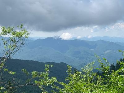
**Hike has been canceled due to forecast of 80% heavy rain and thunderstorms.** This hike has great views and visits two peaks over 6000 ft. New hikers take note: there is a 200-ft. altitude gain over 1/4-mile early in the hike, and two more uphills, each with about 500-ft. altitude gain, in the last leg of the hike. We will begin from FS 816 on the MST, then left onto the Graveyard Ridge Trail to Ivestor Gap. We return on the Art Loeb Trail over Tennent Mtn. and Black Balsam Knob. We’ll stop at the high points to enjoy the great views. This hike is #50 of the 100 Favorite Trails.
Topo(s): Sam Knob,Shining Rock
scout report:
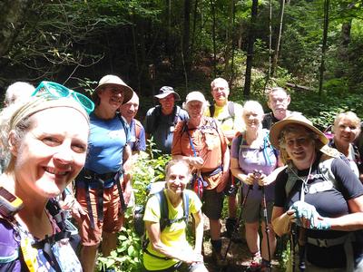
I scouted this hike on 6/18, a picture-perfect day joined by Lorraine and Donna, tracking it at 7 miles with a 1200 ft. ascent. The day started out very cool, windy with some fog. We started on the MST which was very narrow and overgrown with tall grass and shrubs encroaching the trail and a downed tree across one bridge. I submitted a trail issue report and asked if it can be cleared by the time of the hike. Todd E. replied that they will get it done. Turned onto Graveyard Ridge Trail, a wide trail that is very exposed and stopped at Ivestor Gap for a “half” lunch. I’ve never hiked to Black Balsam and Tennent Mt. from this direction or this time year. Blooming Mountain Laurel, Flame Azaleas, Rhododendron, and Wild Raisin were bursting all over, standing out against the blue skies and clear, long range views. We started up the Art Loeb trail to Tennent Mt. walking through trails surrounded by flowering shrubs and had to keep stopping to look around. Photos don’t do it justice. At the TM summit, we took a longer break for a second lunch. We followed the Art Loeb up to Black Balsam, then down and back to the cars. As these trails tend to be, you often find yourself walking in a deep, rocky trench. Poles are recommended. Much of the hike has no shade so hats, sunglasses, sunscreen and extra water are essential. Due to limited parking and the holiday weekend, I’ve changed the meeting times to half an hour earlier.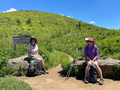
Sunday No. A2203-955-10564 Jul 10, 2022
Andrews Bald & Chimney Tops in Great Smoky Mountains National Park 7:30 AM
Hike 7.1, Drive 165, 2450 ft. ascent, Rated B-AA, ltc
Danny Bernstein, 828-450-0747, dannyhiker@gmail.com
First Meeting Place: Home Depot off Exit 44 of I-40.
Second Meeting Place: Oconoluftee Visitors Center on US 441 at 8:30 AM - but contact leader first.
900M Two hikes in one day, an opportunity to do two of the 100 Favorite Trail hikes. Andrews Bald Hike: 3.6 miles, out-and-back; 850 feet elevation gain. This high-elevation hike leads to a grassy bald with views of surrounding mountains and Fontana Lake. The trail starts at the Clingmans Dome parking area, through the forest to the open bald. We return on the same trail back to our cars. This hike is #20 of the 100 Favorite Trails. We then drive to the Chimney Tops trailhead. Hike: 3.5 miles, out-and-back; 1,600 feet elevation gain. A popular hike leading to an observation viewpoint. The trail is steep with many steps. This hike is #22 of the 100 Favorite Trails. CMC members only, no guests. You must be fully vaccinated against the COVID-19 virus.
scout report:
The meeting place in AVL has been changed to the Home Depot off Exit 44 of I-40. The meeting time is still 7:30 am. The leader and other hikers will already be in the Smokies. Meet the leader and the rest of the group at the Chimney Tops Trailhead at 9:15.hike report:
Chimney Tops is one of the classic hikes of the Smokies. Five of us climbed up on the beautiful stairs built by the Trails Forever program funded by Friends of the Smokies. It was muggy and foggy and there was no view on top. But the weather stayed dry until the end of the hike. Andrews Bald, another classic hike, starts at the foot of Clingmans Dome. This trail was also reconstructed by Trails Forever. By the afternoon, it was raining furiously on Clingmans Dome. No photos.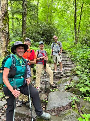
Saturday No. A2203-242-10524 Jul 16, 2022
Sam Knob - Devils Courthouse 8:00 AM
Hike 9.0, Drive 60, 1800 ft. ascent, Rated B-A, p400,sb6k
Brenda Worley, 828-684-8656, cell 828-606-7297, bjdworley@gmail.com
First Meeting Place: Asheville Outlets parking lot behind Waffle House off Exit 33 of I-26.
Second Meeting Place: BRP Cold Mountain Overlook at MM 412 at 8:30 AM
This hike in the cool high elevations is perfect for a hot summer day. From FS 816 we will ascend 6040-ft. Sam Knob with its 360-degree views, then hike through high meadows on the Flat Laurel and Little Sam Trails to reach Devil's Courthouse. Then we return via the MST to FS 816 and our cars. An optional hike to 6214-ft. Black Balsam Knob may be offered. This hike is #53 of the 100 Favorite Trails.
Topo(s): Sam Knob
hike report:
We climbed up Sams Knob and ran into a couple who knew how to get to the other side of the Knob to see the view. So, we enjoyed the view on both sides of the mountain. We continued on to Devils Courthouse and were very glad to find the Little Sam Trail in great shape due to Paul Benson's efforts. Devils Courthouse wasn't too crowded for our lunch stop. After lunch, we got on the MST headed to FS 816 and found the MST in much better shape after the Friday crew's work when they removed two downed trees and did a lot of weed eating. We didn't see rain until we were heading down off Black Balsam on the Art Loeb Spur. Great hike with a great group.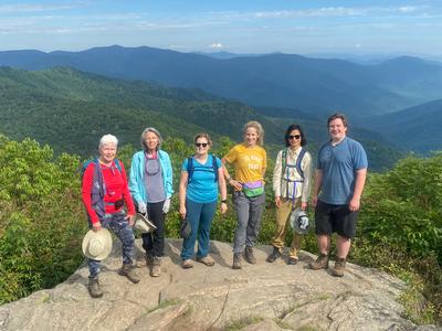
scout report:
Thanks to Sallye who scouted this beautiful and diverse hike with me. We hiked through high weeds and wildflowers on the part of the Sam's Knob Trail which goes through the meadow to Sam's Knob. The very-rocky climb up Sam's Knob resulted in beautiful views. The first part of the Flat Laurel Creek Trail was pretty mucky. The Little Sam Trail has recently been cleared of weeds and blackberry bushes although the footing is rocky and very rutted. We were able to rock hop the two Flat Laurel Creek Crossings. We made it to Devil's Courthouse for lunch and talked with a Forest Service Volunteer of a new program to keep people from climbing on the rocks of the Devil's Courthouse outside the rock walls. This is to protect the rare mosses and sometimes the nesting birds on the rocks. Next, we hooked up with the MST which was very overgrown and muddy in places. There were also a couple of downed trees. I alerted the Trail Maintenance Chairman, and the Friday Crew will be there Friday of this week. However, it would still be a good idea to wear long pants and sleeves because they may not have time to weed eat after they take care of the downed trees. We climbed up the Art Loeb Trail to view a field of Turk's Cap Lilys and returned to our car via the Art Loeb Spur. This hike is only about 8 miles instead of the 9 miles listed in the "Let's Go".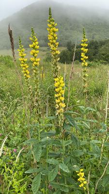
Sunday No. A2203-190-10556 Jul 17, 2022
Mt. Mitchell to Balsam Gap via Blackstock Knob 8:00 AM
Hike 9.5, Drive 70, 1600 ft. ascent, Rated A-A, at-mst, sb6k
Kathy Cornn/Kyle, 828-458-1282, katherinenkyle@gmail.com and Michael Cornn, 828-458-1281, mwcornn@gmail.com
Only Meeting Place: Back parking lot of Folk Art Center. This is one of the really great sections of the MST and includes two SB6K peaks. The first part of the hike features exceptional views south from the Black Mtns., while the second part showcases the trail-building and rock-work achievements of the CMC. See spectacular scenery from our lunch spot on a rocky outcropping. CAR SHUTTLE.
Topo(s): Mt. Mitchell
hike report:
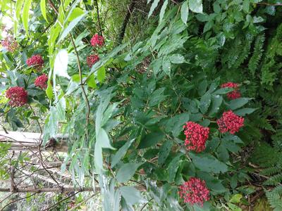
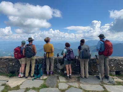
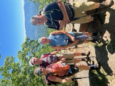
Six of us hiked from Mt. Mitchell to Balsam Gap/Walker Knob via Blackstock Knob. During lunch, we had good views of the North Fork Reservoir - Asheville’s primary water source. A few drops of rain fell after lunch, but not enough to require raincoats. We ran into two CMC hikers Kathleen Hannigan and Jim Reel while climbing toward Blackstock Knob. Turk's-cap lilies and red elderberry were two of the botanical features seen during the hike.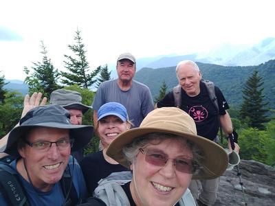
Sunday No. A2203-753-10525 Jul 24, 2022
Cowee Bald Lookout Tower and Alarka Falls 8:00 AM
Hike 7.5, Drive 130, 800 ft. ascent, Rated B-C, ltc
Carroll Koepplinger, 828-231-9444, cakoep29@gmail.com
First Meeting Place: Home Depot off Exit 44 of I-40.
Second Meeting Place: Haywood County Rest Area 19500 Great Smoky Mtn. Expy. (US 23/74) Waynesville NC at 8:30 AM - but contact leader first.
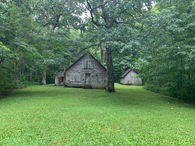
This hike is in a remote part of the Cowee Mountains about 10 miles southwest of the Sylva-Dillsboro area. The hike is in a section of Nantahala National Forest which the Wilderness Society has identified as a "Mountain Treasure" area. This is a two-part hike: hike in and out to the lookout tower on Cowee Bald; drive to Walton trailhead and do a loop hike with an in-and-out to Alarka Falls.
Topo(s): Greens Creek
scout report:
Henry and I scouted this hike Wed. July 20th. It is very apparent that there has been little or no activity on this trail, in some sections, possible for several years. This hike takes in some old forest roads which have a number of challenges. These sections obviously have not seen "boots on the trail" for some years. We were able to clear out some obstacles to make the trail passable but still with a number of challenges along the way. The majority of this scheduled hike is relatively easy to traverse. There will be a number of "over and under" situations. There is a growing Chestnut tree along the trail (a rare sight). Long pants and shirt sleeves are advisable. It is NOT a beginner hikers trail!!Saturday No. A2203-95-10526 (canceled) Jul 30, 2022
Hemphill Bald from Polls Gap 8:00 AM
Hike 9.5, Drive 85, 1600 ft. ascent, Rated A-A,
Thomas Butler, 361-484-3381, butler.tom3381@gmail.com
First Meeting Place: Home Depot off Exit 44 of I-40.
Second Meeting Place: Maggie Valley Post Office at 8:30 AM
900M Form carpools and meet leader at second meeting place. We will hike from Polls Gap to our scenic lunch spot at Hemphill Bald in the GSMNP, with outstanding views. The return route will be via the same trail. This hike is #37 of the 100 Favorite Trails.
Topo(s): Dellwood
Sunday No. A2203-910-10545 Jul 31, 2022
Rocky Fork - Flint Creek 8:30 AM
Hike 7.8, Drive 80, 1860 ft. ascent, Rated B-A,
Les Love, 828-230-1861, lesrlove55@gmail.com and Catherine/Mrs Les Love, 828-658-1489, catmlove2@gmail.com
Only Meeting Place: 160 Zillicoa St. (USFS parking lot) off Exit 25 of I-26. This in-and-out creekside hike showcases the new Rocky Fork State Park and one of its links to the A.T. We will follow the Flint Creek Trail up to Flint Gap on the A.T., then return to the park entrance where we will take the new side trail up to Whitehouse Cliffs for a full view of the Rocky Fork watershed. Our co-leader on this hike will be John Beaudet, who will be sharing history of the Indian battlefield we will cross in the park, as well as his individual efforts to turn around the state's decision to build a visitor center in a pristine area of the park. This hike fills the requirement for #45 of the 100 Favorite Trails.
hike report:
With a forecast of 100% chance of rain, we had several cancelations but others showed up to make a total of 14 and an extremely fun group. After doing our introductions in the parking lot, the Park Ranger, Tim, pulled in to give us a brief history of Rocky Fork SP and future plans to keep it a remote and pristine park, due to popular demand. John Beaudet then led us to the John Sevier Indian Field and gave a wonderful account of this brutal final battle to wipe out the Indians in this part of the country, in spite of peace treaties already being in place. We had lunch at the AT intersection, with more history by John and Nancy East describing her FKT on all the trails in the Smokies NP averaging 32 miles per day. The rain started around 2 pm and 8 of our group decided to call it a day. The others took in the Visitor Center until the sun came back out, then hiked the beautiful, newly constructed trail to Whitehouse Cliffs, returning at 4:30.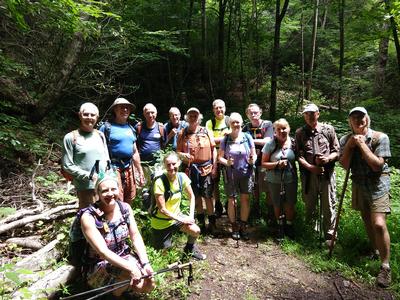
Sunday No. A2203-60-10527 Aug 07, 2022
Pilot Mountain from Gloucester Gap 8:30 AM
Hike 6.5, Drive 80, 2500 ft. ascent, Rated B-AA, p400
Marie Chamberlin, 678-492-6718, marie.m.chamberlin@gmail.com
First Meeting Place: Asheville Outlets parking lot behind Waffle House off Exit 33 of I-26.
Second Meeting Place: Pisgah Forest Walmart parking (back of center aisles close to Taco Bell) at 9:00 AM
This hike starts with a steep climb to the summit of Pilot Mountain, then down to Deep Gap and a short climb over Sassafras Knob. It’s nearly all downhill or level as we continue to Farlow Gap. We’ll return on a pleasant, seldom-used gravel forest road. This hike is #57 of the 100 Favorite Trails. Please do not carpool unless you are fully vaccinated against Covid.
Topo(s): Shining Rock
hike report:
Eight hikers joined me for this loop hike up to the top of Pilot Mountain. Beginning the hike from Gloucester Gap, we climbed up the Art Loeb Trail which gets the heart pumping quickly. There is little relief from the climb, but after almost 2 miles we reached the top of Pilot Mountain and enjoyed a lunch break and fabulous view. We continued on the Art Loeb Trail to Deep Gap Shelter where we sat for a short snack, but as rain was threatening we donned raincoats and headed back on Pilot Mountain Road to the cars. We only had a couple periods of light drizzle which lasted about 15 minutes each. Given the rainy forecast for the afternoon, we were thankful that we did not receive more rain. Total mileage was a little more than 6 miles, and a little more than 1800’ elevation gain. Aside from the top of Pilot Mountain, this hike is almost all in shade.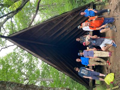
scout report:
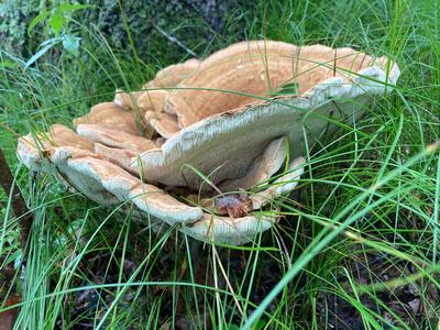
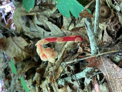
I scouted this on July 11, a day that was cloudy, foggy and not too hot. Thank you to Diane S for scouting it with me. The first 2 1/2 miles of this hike is an uphill climb on the Art Loeb Trail to the top of Pilot Mountain, where on a clear day there would be a great view. However, we saw clouds. There are nice rocks here suitable for a snack break if it isn’t too hot, but there is no shade. We spied blueberries and ate a few ripe ones. The trail continues from here to Deep Gap where there is a large camping area and fallen logs suitable for a lunch break. After lunch we start the mostly downhill portion of the hike back to the cars. About 2 1/2 miles are on a gravel forest road which in places is seriously eroded, perhaps from last fall’s storm, Fred. Then we are back on the Art Loeb trail to retrace our earlier steps back to the cars. Although this hike is usually scheduled in spring to enjoy wildflowers, we were fortunate to see a few edible mushroom species including Chicken of the Woods and Reishi. To arrive at the Gloucester Gap trailhead requires driving 7 1/2 miles on a gravel road (Cathey’s Creek Rd) from Hwy 64. This road is in quite good shape although there are many spots with potholes where you must slow down. The usual route to the trailhead, along Forest Rd 475, is not available at this time due to a closure on this road, also due to Fred. The parking available at the trailhead is along the road or next to a closure gate. It takes approximately 40 minutes to drive from the Walmart in Pisgah Forest to the trailhead. The first photo is Chicken of the Woods and the 2nd photo is Berkeley's Polypore, both edible!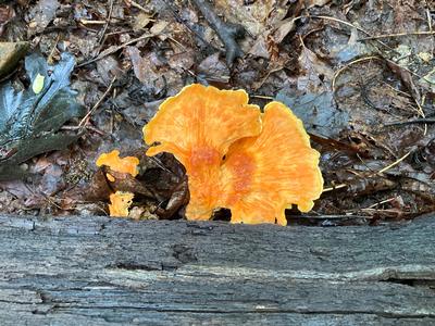
Saturday No. A2203-459-10540 Aug 13, 2022
MST: NC 128 to Glassmine Falls Overlook 10:00 AM
Hike 6.4, Drive 80, 1900 ft. ascent, Rated B-A, at-mst, sb6k
Marcia Bromberg, 828-505-0471, cell 860-798-9905, mwbromberg@yahoo.com
Only Meeting Place: Back parking lot of Folk Art Center. For this shorter version of hike #459 we will head up into the cool, old-growth balsam and spruce forests south of Mount Mitchell. There are several scenic overlooks and we will stop for lunch on one of them. Car shuttle.
Topo(s): Montreat,Mt. Mitchell
hike report:
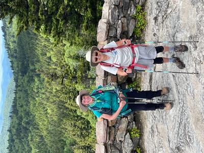
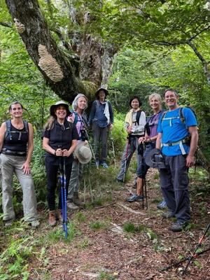
8 hikers enjoyed a perfect day of hiking over Blackstock Knob and onto Glassmine Falls overlook. We picked a few blueberries and blackberries, marveled at the flowers and moss, and even met an MST section hiker going in the other direction. (Bear and dog Bella). In the pictures we stopped to enjoy an interesting fungi growth and posed at the end of the hike.
Sunday No. A2203-699-10558 Aug 14, 2022
Pisgah Loop II 9:00 AM
Hike 6.5, Drive 60, 1500 ft. ascent, Rated B-B, at-mst, p400
Bruce Bente, 828-692-0116, cell 828-567-9443, bbente@bellsouth.net
First Meeting Place: Asheville Outlets parking lot behind Waffle House off Exit 33 of I-26.
Second Meeting Place: BRP Cold Mountain Overlook at MM 412 at 9:30 AM
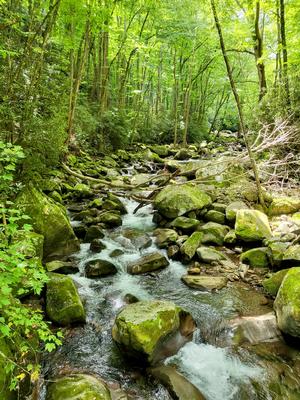
Form carpools and meet leader at second meeting place. This loop hike will go downhill on the boundary trail to the MST, with a stop at Skinny Dip Falls to explore the damage caused by the flood last year and to see the new ladders installed by CMC to descend to creek level and rock-hop the stream. We'll hike up to Graveyard Fields and spend time looking for blueberries before returning to our cars.
Topo(s): Sam Knob,Shining Rock
scout report:
Three hikers scouted the hike a few days ago. The stats are 6.5 miles with a total ascent of 1500'. The hike is moderate and there will be time for a stop for swimming. The hike begins at the overlook just past the busy Graveyard Fields Overlook. We'll hike downhill on the boundary trail, which is in surprisingly good condition, considering that it has not been maintained for ten years. We'll cross the BRP and continue down to the MST, and then turn left to the Skinny Dip area. We'll spend time looking at the damage caused by the 2021 flash flood. The stream crossing consists of staircases on each side and a rock hop over the stream. Next comes a steep 600' ascent before we turn left to cross Graveyard Fields, cross the BRP, climb up to the boundary trail and return to our cars. At Graveyard Fields, a stop at Second Falls will be made to see or swim at this popular location.hike report:
10 hikers enjoyed this moderate 6.5 mile hike in good weather. We spent time looking at the flood-damaged Skinny Dip Falls area.Sunday No. A2203-584-10530 Aug 21, 2022
Butter Gap - Cat Gap Loop 8:30 AM
Hike 9.0, Drive 80, 1900 ft. ascent, Rated B-A, p400
Marie Chamberlin, 678-492-6718, marie.m.chamberlin@gmail.com
First Meeting Place: Asheville Outlets parking lot behind Waffle House off Exit 33 of I-26.
Second Meeting Place: Pisgah Forest Walmart parking (back of center aisles close to Taco Bell) at 9:00 AM
We'll follow the Butter Gap Trail through the beautiful Grogan Creek watershed and Picklesheimer Fields, then follow the Art Loeb Trail, and return on the Cat Gap Trail. A great summer hike with streams, waterfalls and views. This hike is #59 of the 100 Favorite Trails. Please do not carpool unless you are fully vaccinated against Covid.
Topo(s): Rosman
hike report:
Eight hikers joined me for this hike, which has become one of my favorites. Our morning began cool (for summer) and muggy, but rain held off until we were driving home. We hiked clockwise so that the water crossing was at the end of the hike, but the water level was low enough that we were able to rock hop that with ease. Perhaps the bridge that was taken out by Tropical Storm Fred last year will be replaced eventually. We saw at least four yellow jacket nests along the trail, and two people unfortunately were stung. Late summer hikers need to be vigilant to watch out for these pests! The group enjoyed seeing glimpses of Cedar Rock through the trees, and the variability of the trail (dirt, rocks, steep climbs, erosion, boulder field, several rock hops, rhodie tunnels) and we saw quite a few hikers along the trails. I appreciate that all the dogs we encountered were on leash. I am looking forward to hiking this trail in winter and finding the trail to the top of Cedar Rock to enjoy the views.
scout report:
I scouted this hike on Aug. 5 with friends. Thank you to Karen L, Lynn and Glen, and our canine companion Krummholz for going along on this hike. After hearing about a water crossing 1/4 mile from the parking lot, I elected to hike clockwise so that it would be at the end of the hike. We were able to cross by rock hopping; during higher water levels this could be more difficult. The bridge is out due to Tropical Storm Fred last August. We completed the hike in less than 6 hours, including stops. Our route began on Cat Gap Trail and follows along the river for a short distance before climbing. The continuous uphill climb is about 3 miles. Depending on time there are a couple of nice places to stop for a snack break; one is at Cat Gap where we pick up the Art Loeb Trail. We spotted a yellow jacket nest a short distance along Art Loeb. Art Loeb is pretty steep here, but quickly levels off for a pleasant 1/2 mile before descending to Sandy Gap. Not too far beyond Sandy Gap there is a large campsite area with a great view of Cedar Rock that is a possible lunch spot. The trail undulates from here with some ups and downs to Butter Gap where there is an old shelter, and after that the trail is almost all downhill or level to the parking lot. There is so much variety on this trail. We walked on nice dirt paths, interrupted by some rocky sections. We crossed creeks with very little water. There was even a short boulder field section. Art Loeb is quite eroded in places. We walked through rhodie tunnels where it was quite dim because of the thick leaf cover. There are fallen trees to climb over, a couple were about 2 1/2” above the ground; one recent tree fall was a little higher than that which I scrambled under, while taller individuals were able to go over it. We spotted a beautiful variety of mushroom and fungi. We encountered only 5 other hikers and spotted 4 campers at one of the campsites. Although we heard some thunder during the final hour of the hike, the rain held off until we were driving back home. When we hike this on Aug. 21, we could see many more people because it will be a weekend. Of the trails I have hiked, this is one of my favorites.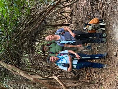
Saturday No. A2203-49-10534 Aug 27, 2022
Big Creek to Walnut Bottom 8:30 AM
Hike 10.3, Drive 110, 1300 ft. ascent, Rated A-B,
Henry Kassell, 845-656-5528, hkassell@gmail.com
First Meeting Place: Home Depot off Exit 44 of I-40.
Second Meeting Place: Pilot Truck Stop off Exit 24 of I-40 at 9:00 AM - but contact leader first.
900M Big Creek, a spectacular mountain stream in the Smokies, offers hikers an opportunity to slow down and appreciate the wild beauty of this section of the park. A comfortable roadbed meanders along rushing rapids, Mouse Creek Falls, huge boulders, and deep swimming holes. A beautiful forest makes for a special experience. A moderate in-and-out hike. This hike is #30 of the 100 Favorite Trails.
Topo(s): Cove Creek Gap,Luftee Knob,Waterville
hike report:
Nine hikers showed up today for a classic sun splashed Smokies hike. We set out up the Big Creek Trail which ascends steadily all the way to Walnut Bottom the site of a camp left over from logging days. There were fellow hikers on the trail, but they appeared to be heading to Midnight Hole to swim and we were going 4 miles further. The water in the brook was just right and the sound was ever present.
Sunday No. A2203-61-10529 Aug 28, 2022
Wayah Bald to Siler Bald 8:00 AM
Hike 12.0, Drive 150, 3050 ft. ascent, Rated A-AA+, at-mst
Donna Lanning, 828-606-7956, dblanning@bellsouth.net
Only Meeting Place: Home Depot off Exit 44 of I-40. Starting at Wayah Gap, we will turn south on the A.T. to 5216-ft. Siler Bald first, climbing a short way off the A.T. in the cooler morning. We will then follow the A.T. northbound to 5342-ft. Wayah Bald, taking a short detour to the Wilson Lick Ranger Station, and then back to our cars. Both balds feature some of the most spectacular 360-degree views in western NC. This exceeds the requirement for #8 of the 100 Favorite Trails.
Topo(s): Wayah Bald
scout report:
Wayah and Siler Balds are beautiful places to be enjoyed on this hike. The views from both are spectacular. I would like to say the woods were cool and shady, however that day they were super humid and shady, we will hope for less humidity on hike day. When I arrived at Wayah Bald not a soul was there, very nice but unusual. So, because of the travel distance (around 1 1/2 hrs one way) and length of the hike, plan for a long day. Thanks to Rosie for her company and bringing her abundant joy to any hike. Donna
hike report:
Sunday was less humid than scout day, thank goodness, but still sticky and warm. We hiked south to Siler Bald first, I was disappointed the pink phlox were gone from the bald but the views were amazing. We then turned around after a snack hiking north on the AT towards Wayah Bald and took a short side trail to Wilson Lick ranger station…very interesting information there on the history of the station and the rangers who originally lived there including the progression to when it was shut down. We continued north to Wayah on a never ending climb to where the Bartram trail comes in and runs with the AT until they split off at the bald. The views at Wayah bald were a little hazy but beautiful as you would expect in the summer. We had lunch in the fire tower and enjoyed a very nice breeze. The trek south back to the cars seemed endless again as we got close, everyone tired as normal after a strenuous hike but happy for completing the challenge of the day. Fun group, discussions ranged from physics to crossword puzzles to complaints about discussions on physics…Donna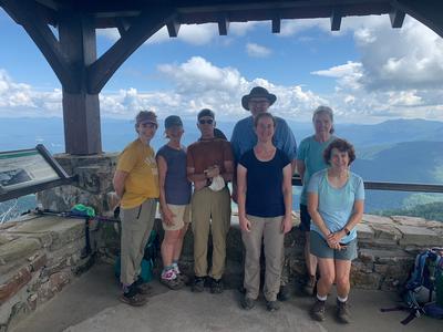
Sunday No. A2203-868-10528 (canceled) Sep 04, 2022
Woodfin Cascades to Waterrock Knob 8:00 AM
Hike 10.4, Drive 65, 2300 ft. ascent, Rated A-AA, at-mst, sb6k
Lorraine Bernhardt, 828-699-8857, lsbernhardt50@gmail.com
Only Meeting Place: Home Depot off Exit 44 of I-40. *Canceled due to rain.* This variation of Hike #868 starts from the Woodfin Cascades Overlook on the Blue Ridge Parkway. We will hike on the MST for 4.8 miles and then take the fairly steep path just above the visitor center to Waterrock Knob for great views. We return via the same route. This hike features an evenly graded trail through various forest types. This hike is #38 of the 100 Favorite Trails.
Topo(s): Hazelwood,Sylva North
scout report:
This was my first time hiking this part of the MST. Initially, the trail is packed dirt but transitions to more rocks as you get closer to Waterrock Knob. The long range views really popped at this point. Interestingly, about 2 miles into the hike the MST trail ended abruptly at the parkway. It wasn’t till 1/2 mile later that it went back into the woods. Thankfully, there were MST markings along the road but that was an unusually large gap. The trail to the top from the visitor center was steep and seemingly endless but we finally arrived and enjoyed a scenic lunch spot. We did not stop at the visitor center. On the way back, we had rain for the last two miles. However, the tree canopy was so thick that we didn’t get too wet. Karen identified various flowers along the way and we had a leisurely ascent. This would be an especially nice hike in October. The ascent is accurate but the GPS indicated a mile longer than stated. Thanks to Donna and Karen for scouting and making this a great day.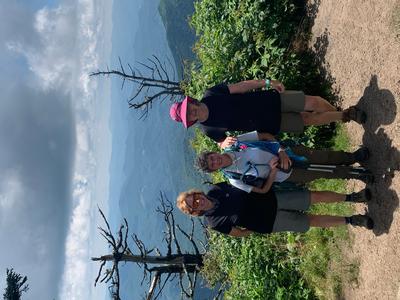
hike report:
Cancelled.Sunday No. A2203-558-10536 Sep 11, 2022
Round Top Ridge to Rich Mtn., A.T. to Hot Springs 8:00 AM
Hike 11.7, Drive 70, 3000 ft. ascent, Rated A-AA, at-mst
Thomas Butler, 361-484-3381, butler.tom3381@gmail.com
Only Meeting Place: 160 Zillicoa St. (USFS parking lot) off Exit 25 of I-26. From the French Broad River near Hot Springs, we climb the A.T. to Lover's Leap Ridge, crossing Pump Gap and Tanyard Gap. Then we'll ascend Rich Mountain to the junction of the Round Top Ridge Trail. There will be an optional in-out to the Rich Mountain fire tower, and then we'll descend on the Round Top Ridge Trail back to the river. This hike exceeds the requirements for #42 of the 100 Favorite Trails.
Topo(s): Hot Springs
hike report:
Five hikers tackled this almost 12 mile loop hike along the AT and the Roundtop Ridge Trail. The hike up to Lover's Leap is steep, and given the humidity, had us all sweating. There are interesting views of Hot Springs, the French Broad, and the large solar farm along the way. We made our way to Mill Pond and found it to be quite low, probably due to a leak in the dam, and then came upon a group of CMC trail maintainers working hard. Just after lunch the rains came and it rained hard for about 45 minutes. The 3.5 miles of the Roundtop Ridge trail was a mixed bag - passable in most areas, but sometimes thick with brambles that made for difficult hiking. I think everyone left a little blood on the trail. The hike closed with a short walk along the road back to our cars parked at the NOC.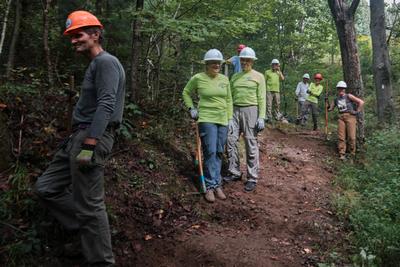
Saturday No. A2203-578-10552 Sep 17, 2022
Flat Laurel Creek, Little Sam Knob, MST Loop 9:00 AM
Hike 6.5, Drive 60, 1000 ft. ascent, Rated B-C, at-mst
Carroll Koepplinger, 828-231-9444, cakoep29@gmail.com
First Meeting Place: Asheville Outlets parking lot behind Waffle House off Exit 33 of I-26.
Second Meeting Place: BRP Cold Mountain Overlook at MM 412 at 9:30 AM - but contact leader first.
**This hike has been rescheduled from 9/10.** Contact leader for reservations. This is a moderate hike in the Pisgah National Forest, starting at the trailhead on NC 215 on the Flat Laurel Creek Trail, passing by Wildcat Falls and out to the falls on Flat Laurel Creek after passing Little Sam Knob. We will continue on the Little Sam Trail to the MST and return. We'll end with a short walk along NC 215 to our cars. Poles are recommended.
Topo(s): Sam Knob
hike report:
Another great day in the mountains for a CMC hike. A small group of six hikers with one new first-time hike with CMC. Welcome, Sue Monsen (she now has the membership form) and will become a new member! We had great weather with sunny skies, temps in the low 60's and low humidity. We started the hike at 10:40 am and returned at 4:10 pm which indicates the leisurely pace for the day.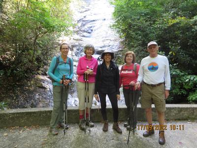
Sunday No. A2203-516-10557 Sep 18, 2022
Lakeshore Loop 8:00 AM
Hike 10.3, Drive 145, 1600 ft. ascent, Rated A-A,
Thomas Butler, 361-484-3381, butler.tom3381@gmail.com
First Meeting Place: Home Depot off Exit 44 of I-40.
Second Meeting Place: Waynesville Publix parking lot east end off Exit 102 of US 23/74 at 8:30 AM
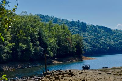
900M Form carpools and meet leader at second meeting place. We will start at the tunnel at the end of Lakeshore Drive and hike Lakeshore, White Oak Branch, Forney Creek, and Goldmine Trails. Along the way we'll learn the history of the infamous Road to Nowhere, settlement and logging along Forney Creek and the development of Lake Fontana. This hike is #19 of the 100 Favorite Trails.
Topo(s): Noland Creek
hike report:
Nice hike in good weather on a well maintained trail. Pretty views along Forney Creek and somewhat at the lunch spot on Fontana Lake, which is being drawn down. Steepest section is on the return on Goldmine Loop. After a long day, and the ascent at the end, we opted to take the shorter bypass trail back to our cars.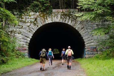
Saturday No. A2203-72-10537 Sep 24, 2022
Graybeard via Pot Cove Gap 8:30 AM
Hike 9.5, Drive 35, 2200 ft. ascent, Rated A-AA,
Judy Magura, 828-606-1490, quilter290@gmail.com and Jim Magura, 828-606-3989, jqs290@gmail.com
Only Meeting Place: Ingles off Exit 64 of I-40 (Black Mountain). This Montreat hike will cross Flat Creek bridge then in one mile, turn right onto trail with rock hops of Flat Creek. A short spur on the right goes to Graybeard Falls. At each trail junction, we'll follow the blue blazes to Graybeard summit (elevation 5408 ft.), with great views. Return will be via the same trail, with the option of a short in-out hike to Walker Knob at the shelter. This hike is #82 of the 100 Favorite Trails.
Topo(s): Montreat
scout report:
Great hike but a bad day for bees. The four of us (Jim, Judy, Sharon and Henry) took the opportunity to have a great day in the woods. We had not been on this trail for some time (12 years ago with Bruce), and found the trail in poor conditions for the first mile as a result of heavy rain. We also found the bees quite active as it was a very warm day. Judy and Henry got stung multiple times at two different parts of the trail. (Note the weather was quite warm at the time of our scout in early September and the peak bee season) We expect to be through this by the time of the group hike. Otherwise we had a great climb, notwithstanding the bee stings, to the top with some views along the way. Our lunch spot will be the top of Graybeard. We descended along the Ridge line for another adventure (not part of this hike) but that is another story.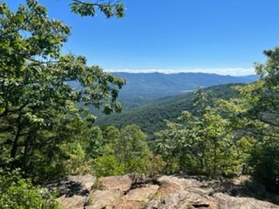
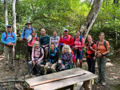
hike report:
We had a great weather day for this Saturday hike with full sun and very comfortable temperatures with 12 hikers on the trail. Leaves were just beginning to turn, so the views up the mountain were not quite as glorious as we had hopped. Never the less, we had a great day on the trail and squeezed in for a lunch break on the top of Graybeard. On the way down, we encountered a large enthusiastic young scout troop scampering up the mountain with a couple of not so enthusiastic older scout leaders Oh to be 13 or 14 again! We did not encounter any bees on the hike but noted that the trail was in very poor condition near the start, but improved midway up. On the return, we took our group photo at the shelter and had a nice break before continuing back to the car. In addition to the scouts, we encountered a lot of other hikers enjoying the day.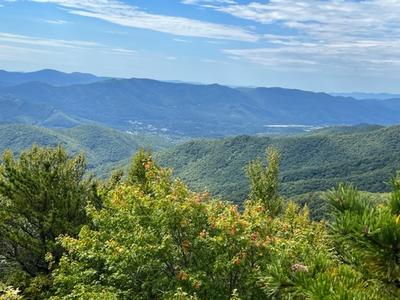
Sunday No. A2203-273-10538 (canceled) Sep 25, 2022
Boogerman Trail 8:00 AM
Hike 8.0, Drive 72, 1100 ft. ascent, Rated B-B,
Mike Knies, 828-628-6712, knies06@att.net
First Meeting Place: Home Depot off Exit 44 of I-40.
Second Meeting Place: Exxon station off Exit 20 of I-40 at 8:30 AM - but contact leader first.
900M A lush forest with giant old-growth trees, stone walls, old cemeteries, former homesites and a root cellar makes this a favorite loop hike in the Cataloochee area of the Smokies. On the way back we will cross Caldwell Fork ten times. Three crossings may be wet depending on water level. Water shoes are fine. Bring poles. This hike is #34 of the 100 Favorite Trails.
Topo(s): Cove Creek Gap