ALL-DAY WEDNESDAY
Wednesday No. W2201-946-10404 Jan 05, 2022
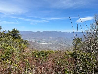
Overmountain Victory Trail to MST to Linville Pinnacle 8:30 AM
Hike 9.0, Drive 90, 1700 ft. ascent, Rated B-A,
Jeff Wilcox, 828-989-8755, jwilcox@unca.edu
Only Meeting Place: River Ridge Market Place behind CVS off Exit 53B of I-40. This new CMC hike begins on the Overmountain Victory Trail in the North Cove area off US 221 (north of Marion). This trail merges with the MST before climbing to the Kistler Highway on the western rim of Linville Gorge. We’ll walk along the road for about a half mile and take the short Pinnacle Trail to an impressive rock outcrop and winter views across the gorge toward Lake James and Shortoff Mountain.
scout report:
This new CMC hike for the new year has almost everything: A steady uphill in the beginning to warm you up, a rocky outcrop with 360-degree views for lunch, and a mostly-downhill back to the cars. The one thing the hike doesn’t have is a lot of parking at the trailhead. We should be able to comfortably fit 3-4 cars along the road, and we can park in 2-3 more cars on the grass (AWD preferred for the latter). I’m sensitive that some people may be hesitant to carpool given the recent rise in Covid cases, but I hate to change the hike because this one is really quite nice. I'm going to temporarily cap the hike at the 12 hikers signed up as of 12/31/2021 and have sent an email to gauge their current plans and/or comfort level with carpooling.hike report:
Wednesday No. W2201-349-10429 Jan 12, 2022
Buck Spring Trail 8:00 AM
Hike 12.0, Drive 44, 1200 ft. ascent, Rated A-B, at-mst, p400
Donna Lanning, 828-606-7956, dblanning@bellsouth.net
First Meeting Place: Asheville Outlets parking lot behind Waffle House off Exit 33 of I-26.
Second Meeting Place: Pisgah Forest Walmart parking (back of center aisles close to Taco Bell) at 8:30 AM
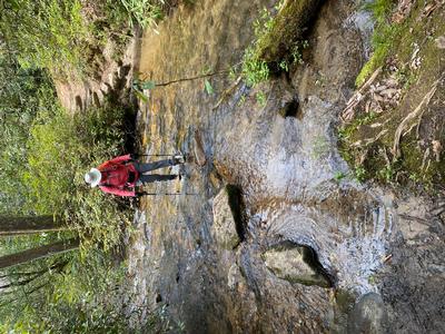
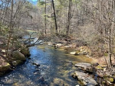
Form carpools at the first meeting place and meet leader at the second meeting place. This lovely hike gradually switchbacks up the mountain with a stronger grade at the finale. There are several easy creek crossings. We will have lunch on the Pisgah Inn porch. After lunch, we will hike back downhill to our cars.
Topo(s): Cruso,Shining Rock
hike report:
Sunday we all started out bundled up expecting cold weather. However, as we walked, layers were shed as it warmed a bit with blue skies, sunshine and no breeze. We encountered no other hikers. Pisgah Inn was very quiet and the views were stunning as always. There were seven of us who enjoyed each other’s company and the perfect weather. Thank you to my pleasant companions who helped make this a lovely day outside. Donnascout report:
This hike is replacing the Little Pisgah Mtn. hike previously scheduled for the 12th. The hike begins at the Buck Springs trailhead on Hwy. 276. It meets up with the MST and we will follow it to Pisgah Inn for lunch. Hopefully there will still be snow around in the Pisgah Mt. area to enjoy as well as the spectacular views. I’ve looked at the forecast and regardless of whether there is snow on the ground, it’s going to be cold! It’s a nice ramble to where we climb switchbacks up to the Inn. The winter views are abundant along the trail. DonnaWednesday No. W2201-676-10392 Jan 12, 2022
Hooker Falls P.L. #4 - circular 8:30 AM
Hike 9.5, Drive 75, 1200 ft. ascent, Rated A-B, wc100
Susan Hutson, 336-406-9279, picassue48@gmail.com
First Meeting Place: Asheville Outlets parking lot behind Waffle House off Exit 33 of I-26.
Second Meeting Place: Pisgah Forest Walmart parking (back of center aisles close to Taco Bell) at 9:00 AM
This hikes takes in four waterfalls, three lakes, and two cemeteries in one wonderful place - Dupont Forest. Scenes from Last of the Mohicans were filmed here.
Topo(s): Standingstone Mtn
hike report:
The hike report disappeared when I tried to post pictures. So I will be brief. Ten of us started out in 23 degree weather which warmed to a sunny 50 degrees. All in all it was a fun hike with the beginning uphill warming all of us up. The waterfalls were all full and only a few respectful bikers were encountered. We ate lunch by lake Imaging. Some even skipped rocks on the ice.Wednesday No. W2201-186-10393 (canceled) Jan 12, 2022
Little Pisgah Mountain 8:30 AM
Hike 11.0, Drive 25, 2000 ft. ascent, Rated A-AA,
Donna Lanning, 828-606-7956, dblanning@bellsouth.net
First Meeting Place: Ingles on US 74-A 225 Charlotte Hwy (Reynolds).
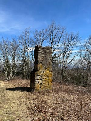
Second Meeting Place: Upper Hickory Nut Gorge Trailhead by chimney on US 74-A at 8:45 AM
Form carpools and meet leader at the second meeting place. We'll hike from the parking lot up into an open meadow leading to the summit of Little Pisgah Mountain. If the weather is clear, the view doesn't get any better.
Topo(s): Bat Cave
hike report:
CANCELLEDWednesday No. W2201-589-10370 (canceled) Jan 19, 2022
Shut-in Trail and Lake Powhatan Loop 9:00 AM
Hike 8.5, Drive 10, 1500 ft. ascent, Rated B-B, at-mst, p400
Danny Bernstein, 828-450-0747, dannyhiker@gmail.com
Only Meeting Place: Asheville Outlets parking lot behind Waffle House off Exit 33 of I-26. This loop hike is a modification of Hike #589 to meet the requirements of Hike #74 of the 100 Favorite Trails. We will walk down from the French Broad Overlook to the trailhead of the Shut-In Trail along NC 191. From there, we will be climbing for about 3.5 miles to Sleepy Gap. We will then descend via a series of trails to Lake Powhatan. After lunch, it will be an easy stroll on Old Bent Creek Gap Road, through the NC Arboretum to NC 191 and back to our cars. CMC members only, no guests. You must be fully vaccinated against the COVID-19 virus.
Topo(s): Asheville
scout report:
Wednesday No. W2201-1-10371 Jan 26, 2022
Case Camp - Seniard Ridge Loop 8:00 AM
Hike 9.8, Drive 80, 1800 ft. ascent, Rated A-A, p400,wc100
Adrianne Chang, 414-690-5424, acjp9349@yahoo.com
First Meeting Place: Asheville Outlets parking lot behind Waffle House off Exit 33 of I-26.
Second Meeting Place: Pisgah Forest Walmart parking (back of center aisles close to Taco Bell) at 8:30 AM
This loop hike is scheduled for our coldest month to see 50-ft. frozen cascades along the closed Blue Ridge Parkway. We'll do a two-mile climb up to the MST and some gentle MST hiking before our lunch spot with great views of the mountains. After lunch, we'll hike downhill through beautiful woods on the Seniard Ridge Trail and get to enjoy the improvements made by trail maintainers Adrianne Chang and Sallye Sanders. We will pass two nice waterfalls along an old logging road.
Topo(s): Shining Rock
scout report:
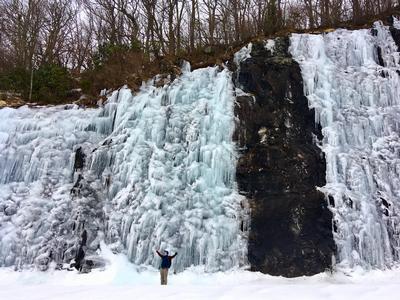
Sallye Sanders and I scouted the trail on a gorgeous warm day January 12. The gate to 475B (Headwaters Rd) was still open, however the gate will likely be closed on January 26. We started with the steep ascent (1000+’ elevation gain) up Case Camp for 1 ½ miles to the Blue Ridge Parkway, then climbed some more on the MST, and had lunch on the parkway around 11:00am. Even on this warm day there were gorgeous icicles along the parkway. The trail was dry with leaves but could be a little slick if wet or icy (poles are highly recommended). There were several downed trees on the trails and lots of large branches and leaves. We tried to sweep the steep downhill areas on Seniard Ridge and sawed and removed some smaller trees on the path. Both Logging Road Falls and Log Hollow Falls were flowing.hike report:
This hike was rescheduled from January 26 to February 2 due to slick snow and ice conditions on the road and trails. In an unusual fate of luck, the gate to Headwaters Road (475B) was open so we could drive to the trailhead (AWD required). Beginning at 9:15 a.m., four of us braved overcast and cool weather to the challenging climb up Case Camp Trail to the Blue Ridge Parkway. There were some snow covered areas of the trail but it was not icy slick (Brenda used spikes while the rest of us wore boots with good treads). Figuring the MST would have deeper snow on the trail, we walked the parkway instead and treaded through some snow. The views of the mountains, Looking Glass Rock, and the clouds were amazing and we were blessed with stunning ice formations! So we decided to hike further to the East Fork Overlook and saw the most incredible ice formations. As it started to get cooler, we hiked down Seniard Ridge to find a more sheltered lunch spot. Descending Seniard Ridge we experienced some snowy areas and some clear conditions (thanks again to crew trail maintainers and Section Rovers for the additions of many steps and for Sallye and Adrianne raking leaves and clearing some trees). After short stops to view Logging Road Falls and Log Hollow Falls (with some ice formations), we headed back to our cars at 1:30 p.m. Thanks again to Brenda and Sallye, and for Paul B recommending the hike to East Fork Overlook! (NOTE: we all agreed it was better not taking the MST and expending our energy to walk to the East Fork Overlook!)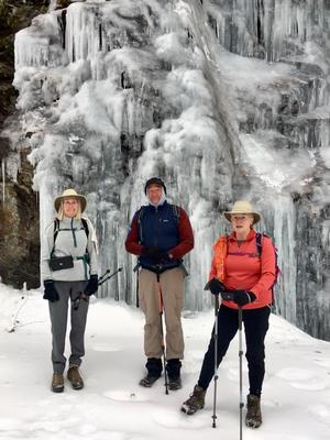
Wednesday No. W2201-281-10390 Jan 26, 2022
Green River Gamelands - East Side 8:00 AM
Hike 9.0, Drive 70, 1000 ft. ascent, Rated B-C,
Steve Pierce, 828-442-8482, stevepierce50@gmail.com
First Meeting Place: Asheville Outlets parking lot behind Waffle House off Exit 33 of I-26.
Second Meeting Place: Cracker Barrel Restaurant off Exit 53 of I-26 in parking lot close to I-26 at 8:30 AM
This hike has been modified to meet the requirements of #71 of the 100 Favorite Trails. We will start on Long Ridge Trail, continue on Turkey Gut Trail and then Bluff Trail to reach the Green River Cove Trail. We will stay on the Green River Cove Trail to its end at the big rocks in the river. After lunch, we will ascend the 0.75 mile back to the junction with Pulliam Creek Trail. We will take that trail to Big Hungry Road and then walk the last mile of that road back to our cars.
Topo(s): Cliffield Mtn
hike report:
Twelve hikers started out on a cold morning on this 9-mile loop hike in the Green River Game Lands. Some snow/ice on the trails at the top, but warmer temps along the river gave us clear trails. We saw a couple kayakers as we approached our lunch spot at the “big rocks” on the river. After lunch the climbing began up Pulliam Creek Trail. A couple ice covered “Indiana Jones” bridges made the hike interesting, but everyone remained vertical! We were all successful with the rock hop crossing of Pulliam Creek. We opted to close the loop with the Rock Hop Trail and an unnamed roadbed rather than a walk along Big Hungry Road. There were two rock hop crossings on the eponymous Rock Hop Trail with only a couple wet feet. We arrived at the cars at 2:20. Thanks hikers for a good day.scout report:
Randy, Rich and I scouted the hike on a cold and clear day. The hike begins at the Long Ridge Trailhead with a gravel road walk and then a single track trail. The descent from the trailhead to the river is a little over 1,000 ft. over 2+ miles on fairly well graded trails. The Green River Cove Trail affords river views with several ascents and descents. Our lunch spot is at the big rocks on the river. We saw two kayakers plying the cold waters. Following lunch, the Pulliam Creek Trail is a steady climb with some more level stretches. There is one creek crossing that we were able to successfully rock hop. At the junction with the Rock Hop Trail, we opted to use it to return to the cars rather than the road walk that is in the hike description. As the trail name implies, there are two creek crossings that require rock hopping to keep dry feet. There is a connector using Bishop Branch Trail and an unnamed old road that led us to the parking area. Due to the three water crossings, poles are highly recommended. The hike was 9.7 miles with elevation gain and loss roughly equal at 1.400 ft. We completed the hike in 5 ½ hours.Wednesday No. W2201-527-10411 (canceled) Feb 02, 2022
Ellicott Rock via Chattooga River Trail 8:00 AM
Hike 8.0, Drive 150, 500 ft. ascent, Rated B-C, wc100
Sallye Sanders, 208-550-2070, sallye_sanders@yahoo.com
First Meeting Place: Asheville Outlets parking lot behind Waffle House off Exit 33 of I-26.
Second Meeting Place: Pisgah Forest Walmart parking (back of center aisles close to Taco Bell) at 8:30 AM
Form carpools and meet leader at second meeting place. This hike has gentle grades and goes along the Chattooga River. We will be hiking in the area where three states converge -- North Carolina, South Carolina and Georgia. We will also make side trips to Spoonauger Falls and Kings Creek Falls. NOTE: We will not be going down the embankment to view Ellicott Rock from the river.
Topo(s): Tamassee
scout report:
Brenda Worley and Adrianne Chang scouted the hike with me and we all agreed that the hike was tougher than we remembered because of more blowdown and narrow eroded trail. The trail is within the Ellicott Wilderness. Downfall has been cleared closer to the beginning of the trail but not further along the trail. There are two creek crossings, one of which is a pretty easy rockhop but the second is more difficult and it is nice to have waterproof boots!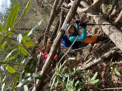
Wednesday No. W2201-847-10372 Feb 02, 2022
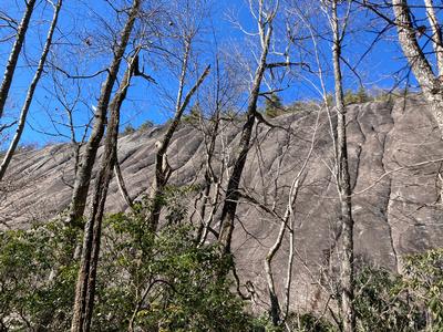
Pinnacle 8:30 AM
Hike 8.0, Drive 90, 2500 ft. ascent, Rated B-AA,
Marie Chamberlin, 678-492-6718, marie.m.chamberlin@gmail.com
First Meeting Place: Home Depot off Exit 44 of I-40.
Second Meeting Place: Haywood County Rest Area 19500 Great Smoky Mtn. Expy. (US 23/74) Waynesville NC at 9:00 AM - but contact leader first.
This hike is from the Fisher Creek Recreation Area near Sylva. We will ascend on the East Fork and Pinnacle Trails to see the great view from the Pinnacle. Our return will be via the West Fork Trail. Limit of 10 hikers. This hike is #15 of the 100 Favorite Trails.
Topo(s): Sylva North
scout report:
On a beautiful winter day I scouted this hike with a couple of CMC friends. We started up the West Fork trail and then out to Pinnacle. As others have stated the trail is steep in places, but mostly a gradual continuous uphill climb until the turn off to the Pinnacle. At Pinnacle there is a terrific place to have an early lunch with views in all directions. After lunch we retraced out steps back to the main trail and headed uphill again for a short distance before getting on the East Fork trail to head back to the parking lot. Portions of East Fork are extremely steep so it was slow going at times. We spied many many large trees that have fallen, but they have been cleared from the trail. Encountered several icy places on the trails as it was about 25 degrees when we started but warmed up to 50ish by the afternoon. Total time about 5 hours including a half hour lunch break on the Pinnacle. Thank you to Karen and Ken Scharmann for scouting with me!hike report:
Eight hardy hikers joined me on a trek to the Pinnacle. Clouds were present all day long and we started hiking with temperature about 37. We hiked uphill along the West Fork, and stopped for a short break and pictures at a very large rock with a split in it. This trail is quite steep so we stopped several times for water/clothing adjustment breaks. The offshoot trail to the Pinnacle was mostly all snow covered so we had to step carefully. However, no one wanted to turn back as several of us wanted to check this trail off of the 100 Favorite Hikes challenge! We walked out to the Pinnacle and enjoyed fabulous views of mountains and a town in the distance even though the clouds were still present. All agreed the trek through the snow was worth it after seeing the views! We enjoyed a shortened lunch break away from the Pinnacle near a fire pit where we were protected from the worst of the wind. My thermometer measured about 32 degrees! I was envious of those who had thermoses of hot tea and am seriously considering purchasing a small thermos myself. The walk back to the main trail was slow going at times because of going downhill on that snow. Once back on the main trail we continued on to the East Fork back to the parking lot. We encountered several places where snow was still present until we reached lower elevation. The East Fork has a steep section and several tree falls to navigate over, but thankfully this portion of the trail had no snow. The temperature rise as we walked downhill was noticeable, and was in the upper 40’s by the end of the hike. What a great hike this is! Hiking this in spring when rhodies and mountain laurel are in bloom would be fun to try.Wednesday No. W2201-421-10373 Feb 09, 2022
Canebrake Trail 8:00 AM
Hike 11.0, Drive 90, 1900 ft. ascent, Rated A-A,
Kay Haskell, 610-613-4858, HaskellKM@Gmail.com and Marie Chamberlin, 678-492-6718, marie.m.chamberlin@gmail.com
First Meeting Place: Asheville Outlets parking lot behind Waffle House off Exit 33 of I-26.
Second Meeting Place: Pisgah Forest Walmart parking (back of center aisles close to Taco Bell) at 8:30 AM - but contact leader first.
This hike will start at the Frozen Creek Rd. parking lot in Gorges State Park and go down the Canebrake Trail to our lunch spot at the Foothills Trail pedestrian bridge, where the Toxaway River enters Lake Jocassee. Return via same route. The trail is an old logging road. Our hike back will have a steady but moderate incline.
Topo(s): Reid
hike report:
Ten of us set off at 9:15 and returned to the trailhead parking lot at 3. We had a sunny bright blue sky winter day with our starting temperature hovering around 30 degrees and climbing up to nearly 50 by the afternoon. The treat of this hike is lunch on the rocks where Toxaway River feeds into Lake Jocassee. We all walked the full length of suspension bridge, looked across the shimmering lake, and explored the campsite. The five miles back is a long gradual uphill and the comradery of fellow hikers made the climb much more enjoyable. Two of us recorded 11.2 as the distance of this in and out hike.

scout report:
Our scout hike was on a clear but chilly day in January. Our starting temperature was 29 degrees. Although our car’s GPS followed the CMC directions, the left turn onto Frozen Creek Road is easy to miss because there isn’t a street sign. There are two signs at the turn: The Wilds or Ridge Haven. The trail is wide and well-marked. We had two beautiful peeks at Lake Jocassee as we neared the downward portion. The suspension bridge, view of the lake, and the Toxaway River at our lunch stop were spectacular. Retracing our steps, we found the altitude gain up the trail back kept us warm. The hiking distance had been recorded at 10 miles. All-trails gave us two different distances: 11.2 or 11.6.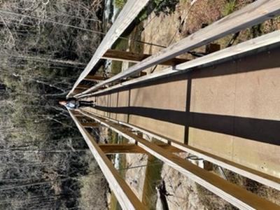
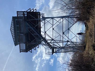
Wednesday No. W2201-373-10375 Feb 16, 2022
Yellow Mountain 8:00 AM
Hike 12.9, Drive 125, 3100 ft. ascent, Rated AA-AA+, ltc
Thomas Butler, 361-484-3381, butler.tom3381@gmail.com
First Meeting Place: Home Depot off Exit 44 of I-40.
Second Meeting Place: Waynesville Publix parking lot east end off Exit 102 of US 23/74 at 8:30 AM
Form carpools and meet leader at second meeting place. We’ll hike in the Cowee Mountains on a heavily-forested, high-altitude trail that ascends four peaks going in and three on the way back. Views from the Yellow Mountain observation tower are great – a fine lunch spot. Strenuous but rewarding. This hike is #9 of the 100 Favorite Trails.
Topo(s): Glenville,Highlands
hike report:
Five of us began this 13 mile hike in cloudy and cold conditions. One had to turn back at approximately the 3 mile mark due to a calf injury. The rest enjoyed a strenuous hike in gradually improving weather conditions. The last two miles to the summit of Yellow Mountain were particularly steep and sloppy, muddy and wet from recent rains, but the views from the top were excellent, with mostly clear skies. The trip back was also strenuous as we had to summit Shortoff Mountain. All were glad to reach the cars and change into dry socks and shoes.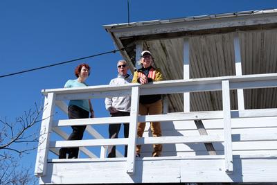
Wednesday No. W2201-295-10374 Feb 16, 2022
Pump Gap and Lover's Leap Loop 9:00 AM
Hike 7.0, Drive 80, 1400 ft. ascent, Rated B-B, at-mst
Bev MacDowell, 828-777-5806, bevmacdowellhappy@gmail.com
Only Meeting Place: 160 Zillicoa St. (USFS parking lot) off Exit 25 of I-26. From the Silvermine Trailhead, we will climb up to the ridgeline and visit an old cemetery. We will then continue on the A.T. past Lover's Leap overlook and walk along the French Broad River back to our cars. This hike meets the requirements of #41 of the 100 Favorite Trails. NOTE: Possibility of lunch or an early dinner in Hot Springs if anyone is interested; please let hike leader know.
Topo(s): Hot Springs
scout report:
Jane Corbin & I scouted this hike on the last day of January. We encountered snow on the shaded sides of the trails, left from the two recent storms. We had to scramble through, over and around a lot of downfall. This has been reported and Friday Crew plans to work there this week. It's always a beautiful hike with loads of winter views on the 1st half. The 2nd half includes an old family cemetery up high and lovely forest walk with stream. There are two larger rock hop crossings. Poles are highly recommended.hike report:
We were 13 'LUCKY' hikers on this partly sunny and mild February Wednesday. It was a pleasant walk, thanks to the muscle of the Friday Crew, including 3 sawyers. They worked five days before our hike on the beating this area took in the recent snowstorms. We enjoyed lunch at the camp site just before the first Pump Gap crossing. This group enjoyed similar pace and a happy time was had by all.
Wednesday No. W2201-916-10403 Feb 23, 2022
Toms Creek to Woods Mountain 8:30 AM
Hike 8.0, Drive 80, 1400 ft. ascent, Rated B-B,
Jim Reel, 828-443-2532, jimr57@yahoo.com and Kathleen Hannigan, 828-230-4883, kathannigan@gmail.com
First Meeting Place: River Ridge Market Place behind CVS off Exit 53B of I-40.
Second Meeting Place: McDonald's at US 70 and US 221 Bypass in Marion at 9:00 AM
Meet Kathleen and form carpools at first meeting place and meet co-leader at second meeting place. This new CMC hike will explore the lower south side of Woods Mountain, beginning off Old Toms Creek Rd. We will follow Toms Creek to a junction with the MST We will follow it a short distance to Harris Creek Trail and follow it around the base of Woods Mountain. Near the end of the hike we will have a short bushwhack to Toms Creek Falls and climb out the top of the falls on our way to the end of the trail at 469A. There will be three possible wet creek crossings. Be prepared. Car shuttle.
hike report:
This hike was postponed due to rain and rescheduled for March 3rd. It was another awesome beautiful morning in the Grandfather Ranger District as 9 hikers set out along Toms Creek on the Woods Mtn Trail. We were on a short section of MST until it crossed Tom Creek and we continued on to cross several tributaries. We had lunch in a beautiful sunny spot at the crossing of Harris Creek. We crossed a couple of more tributaries and ridgelines before coming out just above Toms Creek Falls. We hiked in and out of the falls from above. After a break at he falls for pictures, we followed a moss covered fire road for about a mile to our shuttle cars. The end of a great day of hiking and another day in paradise in the woods!!! Thanks to all who came out and a great big thanks to Kathleen for leading with me!!
Wednesday No. W2201-882-10410 (canceled) Feb 23, 2022
Panthertown Waterfalls 8:30 AM
Hike 8.5, Drive 110, 1440 ft. ascent, Rated B-B, wc100
Brenda Worley, 828-684-8656, cell 828-606-7297, bjdworley@gmail.com
First Meeting Place: Asheville Outlets parking lot behind Waffle House off Exit 33 of I-26.
Second Meeting Place: Pisgah Forest Walmart parking (back of center aisles close to Taco Bell) at 9:00 AM
Form carpools and meet leader at second meeting place. This loop hike will take us to 3 waterfalls and one outstanding summit with beautiful views. We begin on Macs Gap Trail, then hook up with Greenland Creek Trail to Greenland Creek Falls. Next, we will take the Great Wall Trail to Granny Burrell Falls and then loop around to connect with Little Green Mountain Trail to the summit and Tranquility Point. From there we return to our cars with a stop at Schoolhouse Falls. This hike meets the requirements of #14 of the 100 Favorite Trails.
Topo(s): Big Ridge,Lake Toxaway
scout report:
Thanks to Sallye and Adrianne for scouting this hike with me a couple of weeks ago. We started out on the Macs Gap Trail, continued on the Greenland Creek Trail to Greenland Falls where we found the trail snow and ice covered. The Greenland Falls was beautiful. This hike requires we cross the Greenland Creek to connect back up with Macs Gap Trail to Little Green Mountain. The creek can be rock hopped, but high-topped water-proof boots are necessary to keep the feet dry. Polls are also suggested. The rocks on Little Green were ice covered in places, but Tranquility Point was fine with great views. We didn't make it to Granny Burrell Falls because the trail was very muddy. So, we made an attempt to hike to Warden Falls instead after Schoolhouse Falls and we found this trail under water and over our boots. Hopefully, it will be in better shape when we actually hike it.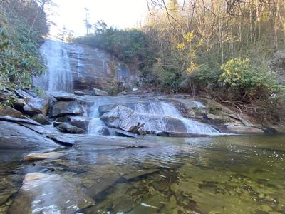
hike report:
Wednesday No. W2201-89-10381 Mar 02, 2022
Lemon Gap to Max Patch 8:00 AM
Hike 11.0, Drive 104, 1800 ft. ascent, Rated A-A, at-mst
Brenda Worley, 828-684-8656, cell 828-606-7297, bjdworley@gmail.com
First Meeting Place: Home Depot off Exit 44 of I-40.
Second Meeting Place: Pilot Truck Stop off Exit 24 of I-40 at 8:30 AM - but contact leader first.
We’ll see the A.T. shelter built by the CMC along a beautiful section of the A.T. We will begin at Lemon Gap, have lunch on top of Max Patch with its beautiful views and return to our cars at Lemon Gap. This hike is #39 of the 100 Favorite Trails.
Topo(s): Hot Springs
hike report:
Twelve of us had a beautiful day hiking on the AT. We saw a couple of through hikers and a couple of downed trees which I reported to trail maintenance. There were no early wildflowers, but we enjoyed beautiful views on top of Max Patch. I had a knee problem and couldn't return with the group. Sallye Sanders led the group back to Lemon Gap and I returned to the parking lot of Max Patch with Adrianne Chang. I was out of hiking for about a month because of this problem. Everyone else had a great 11-mile hike. Mine and Adrianne's hike was only 6 and 1/2 mile.
scout report:
Wednesday No. W2201-325-10382 Mar 02, 2022
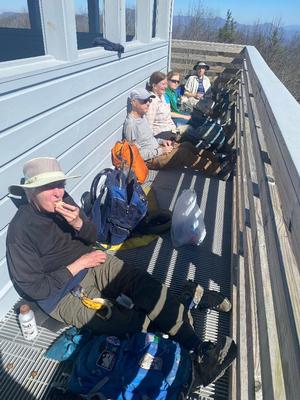
Tanyard Gap to Rich Mountain 10:00 AM
Hike 5.5, Drive 70, 1350 ft. ascent, Rated C-B, at-mst, ltc
George Shepherd, 405-596-2632, shepherdgeorge@att.net
Only Meeting Place: 160 Zillicoa St. (USFS parking lot) off Exit 25 of I-26. This moderate in-and-out hike features great views from the Rich Mountain fire tower near Hot Springs. We follow the A.T. north from Tanyard Gap, then take a short side trail to the fire tower, and return via the A.T. This hike is #42 of the 100 Favorite Trails.
Topo(s): Hot Springs
scout report:
Thanks to Annie & Alice for helping me scout on 2/16. Got started at 11:15. Nice sunny day but windy at times, especially on top the tower. The AT is in great shape, only one small, easy-to-cross blowdown. The trail is uphill almost all the way but never severe. Had lunch on the ground south of the tower. With the sun & protected from the wind, it was just plain warm there (even though temps were in the 40’s.) Great views from top of the tower. One caution: the side trail to the tower had some slick spots. Where it was slightly muddy it was steep enough that we slid in places. Trekking polls are a must. With all the rain expected this week those slick spots will be much worse. Good news is the are no (well, barely any) water crossings. We finished this short hike at 3:00 and I expect we'll move about that quickly on the 2nd. Saw about 8 other hikers. There are reasons this is on the list of 100 favorite trails. There are several spots still open on this hike if you want to go.
hike report:
8 hikers enjoyed a beautiful sunny day hiking on the AT & side trail to Rich Mt.Fire Tower. At the trailhead we had noticed Jennifer Pharr Davis' vehicle and wondered if we'd see her on the hike. We met her as we went up the trail as she lead students from a private school in SC back from the tower. In the afternoon, we met another group going up led by her husband. Lunch was at the tower. Beautiful views, very clear day. We also stopped and visited with 4 through hikers and several other folks out for the day. HIke started at 10:50. Off trail at 3:15. Ironically, a CMC meet up hike that had been postponed did the same hike the day before!
Wednesday No. W2201-516-10383 (canceled) Mar 09, 2022
Lakeshore Loop 8:00 AM
Hike 10.3, 1600 ft. ascent, Rated A-A,
Thomas Butler, 361-484-3381, butler.tom3381@gmail.com
First Meeting Place: Home Depot off Exit 44 of I-40.
Second Meeting Place: Waynesville Publix parking lot east end off Exit 102 of US 23/74 at 8:30 AM
900M Form carpools and meet leader at second meeting place. We will start at the tunnel at the end of the Lakeshore Drive and hike Lakeshore, White Oak Branch, Forney Creek, and Goldmine Trails. Learn the history of the infamous Road to Nowhere, settlement and logging along Forney Creek and the development of Lake Fontana. We will visit some old home and farm sites and discuss the way of life of the pre-GSMNP inhabitants, and may visit some cemeteries. This hike is #19 of the 100 Favorite Trails.
Topo(s): Noland Creek
scout report:
We scouted this hike on 2/19 on a beautiful sunny day, following several rainy days. The trail was in excellent condition, with mostly easy water crossings and a few rockhoppers. We avoided one crossing that was too deep and swift by finding a short path around it. The first half of the hike is more down than up, followed by a very moderate climb for the last miles. In between, the hike is along Forney Creek, which was roaring from the recent rains, and is pretty flat. The lunch spot near a campsite would normally be at the edge of Lake Fontana, but because of the annual water drawdown was actually quite far from the lake. We had our lunch on the (dry) lake bottom instead. We skipped the Goldmine Loop portion of the hike. Overall an easy to moderate 9 mile hike.
Wednesday No. W2201-947-10377 (canceled) Mar 09, 2022
Woods Mtn. Via MST and Toms Creek 8:30 AM
Hike 9.0, Drive 75, 2700 ft. ascent, Rated B-AA,
Jim Reel, 828-443-2532, jimr57@yahoo.com and Melissa Gibson, 803-627-0867, MelJ.Gibson27@gmail.com
First Meeting Place: River Ridge Market Place across from McDonald's off Exit 53B of I-40.
Second Meeting Place: McDonald's at US 70 and US 221 Bypass in Marion at 9:00 AM
Meet Melissa at River Ridge and form carpools. Meet Jim at second meeting place and set up a short car shuttle. We will start out along Toms Creek and quickly begin to gain elevation. After about a mile we intersect the MST. We will follow the MST and enjoy awesome winter views, including Lake Tahoma, as we ascend the mountain. At about 4 miles we turn off the MST and follow a faint trail to the summit of Woods Mountain. We will leave the summit of Woods Mountain on an old trail along the ridgeline. Then we will turn off the ridgeline and hike down through the open forest as we follow parts of old roads and trails to the bottom of Toms Creek Falls. After enjoying the falls we will climb out from the top of the falls and around an old forest road back to our cars. NOTE: Toms Creek Falls is a tourist destination, but the tourists don’t come in and out of the falls from the direction that we will. There will be a limit of 12 hikers.
hike report:
Canceled due to rainWednesday No. W2201-592-10384 (canceled) Mar 16, 2022
Butter Gap - Long Branch Loop 8:30 AM
Hike 10.0, Drive 70, 1950 ft. ascent, Rated A-A, p400,wc100
Richard Sampson, 704-453-9059, richsampson360@gmail.com
First Meeting Place: Asheville Outlets parking lot behind Waffle House off Exit 33 of I-26.
Second Meeting Place: Pisgah Forest Fish Hatchery off FS 475 at 9:00 AM
Form carpools and meet leader at second meeting place. This hike will start at Gloucester Gap and follow the Art Loeb Trail over Chestnut Mountain to Butter Gap. At the gap, we’ll turn downhill onto the Butter Gap Trail, then the Long Branch Trail and Cemetery Loop past the McCall Cemetery . There will be a short side trip to a beautiful but rarely visited waterfall. We’ll finish with a short road walk back to the trailhead. Short car shuttle. This hike is #58 of the 100 Favorite Trails. NOTE: We are keeping our fingers crossed that the parking lot at the Fish Hatchery will be open by hike time and that FS 475 will be open to Gloucester Gap as well. A replacement hike will be selected if the closures are still in place.
Topo(s): Shining Rock
scout report:
IMPORTANT: This hike has been cancelled and replaced on the same date by the Cat Gap Butter Gap Loop due to road damage from last Fall's flooding.Wednesday No. W2201-72-10385 (canceled) Mar 16, 2022
Graybeard via Pot Cove Gap 8:30 AM
Hike 9.5, Drive 35, 2450 ft. ascent, Rated A-AA,
Karen Schultz, 312-241-3329, schultz.karenj@gmail.com and Ken Scharmann, 847-772-4693, kennethscharmann@gmail.com
Only Meeting Place: River Ridge Market Place behind CVS off Exit 53B of I-40. This Montreat hike will cross Flat Creek bridge and turn right onto trail in one mile, with rock hops of Flat Creek. Short spur on right goes to Graybeard Falls. At each trail junction, follow blue blazes to Graybeard summit (elevation 5408-ft.) with great views. Return via same trail, with option of short in-out hike to Walker Knob at the shelter. This hike is #82 of the 100 Favorite Trails.
Topo(s): Montreat
scout report:
Thanks to Danny B. for scouting this hike with Ken and Karen on a beautiful, sunny day with a high of about 70! This is a great hike in the beautiful Montreat wilderness area. This 10.25 mile hike has a little bit of everything. The first part of the hike was quite rocky and included about 4 stream crossings. The midsection of the hike had several nice trail sections following a number of switchbacks, which made for a gradual climb to the shelter at Walker's Knob. This section of the trail had several muddy patches that needed careful navigation. The final section of the hike is a 1 mile climb to the Graybeard Summit from Walker's Knob and is steep and rocky. Poles and sturdier hiking shoes are recommended. The total elevation gain was 2,625 feet and our total time on the hike was about 7 hours. This included a short snack break, and a trail break at Walker's Knob before ascending to the Graybeard Summit. We will eat lunch at the shelter at Walker's Knob after coming down from the summit. We will also include a 5 minute walk after lunch to a beautiful viewing area before heading back down. We look forward to hiking this lovely and somewhat challenging trail with you all.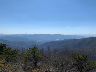
hike report:
Hike canceled due to rain forecast.Wednesday No. W2201-584-10430 (canceled) Mar 16, 2022
Butter Gap - Cat Gap Loop 8:30 AM
Hike 9.0, Drive 80, 1900 ft. ascent, Rated B-A, p400
Richard Sampson, 704-453-9059, richsampson360@gmail.com
First Meeting Place: Asheville Outlets parking lot behind Waffle House off Exit 33 of I-26.
Second Meeting Place: Pisgah Forest Fish Hatchery off FS 475 at 9:00 AM
Form carpools and meet leader at the second meeting place. This hike will start at the Fish Hatchery and follow the Cat Gap Loop Trail to the Butter Gap Trail. Then we’ll follow the Art Loeb Trail to Cat Gap Loop Trail back to the parking lot. This hike is #59 of the 100 Favorite Trails and is replacing the previously scheduled Butter Gap / Long Branch Loop hike. Topo: Shining Rock.
Topo(s): Rosman
scout report:
100mFavorite; Pisgah 100 February 9th Steve Pierce, Randy Fluharty and I scouted this hike. The first 4 miles are a gradual climb of about 800 feet elevation to Butter Gap. From there the trail is up and down gaining another 400 feet to the high point at Cedar Rock. We got some impressive closeup views of the massive rock. The next two miles are steadily down hill before flattening out for the last mile. The trails were all in good condition, but three water crossings showed the effects of last Fall’s flash floods. Less than a half mile in from the Fish Hatchery parking lot we found the bridge over Cedar Rock Creek had been washed out. It was not an easy rock-hop across but we were able to do it safely. One of the three of us got a boot wet so you might need to be prepared for that possibility. But with the dryer and warmer days the crossing may not be difficult. Near the end of the hike was another rock hop water crossing that was a bit tricky but not as difficult as the first. The last half mile is an easy flat trail along the river, where we saw huge rocks that had been rearranged by the floods. The bridge over the Davidson River near the end of the trail was destroyed out with no way to cross. We backtracked a short way and bushwhacked up a steep slope to the road. We will have an option to eliminate the bushwhack and take a road walk for the last mile.
Wednesday No. W2201-880-10386 (canceled) Mar 23, 2022
Garenflo Gap - Tanyard Gap 8:30 AM
Hike 12.5, Drive 90, 2000 ft. ascent, Rated AA-AA, at-mst
Tish Desjardins, 828-380-1452, desraylet@aol.com
First Meeting Place: 160 Zillicoa St. (USFS parking lot) off Exit 25 of I-26.
Second Meeting Place: Corner of US 25/70 & NC 208 at 9:00 AM
Form carpools and meet leader at second meeting place. We'll hike the A.T. from Garenflo Gap to Tanyard Gap. Thankfully, the dirt portion of Garenflo Gap Road has recently been improved by the Forest Service. We'll stop for ice cream half way through the hike in downtown Hot Springs. Car shuttle.
Topo(s): Hot Springs,Spring Creek
hike report:
Hike was canceled due to weather.Wednesday No. W2201-324-10387 (canceled) Mar 23, 2022
Bent Creek Loop #4 9:30 AM
Hike 5.0, Drive 15, 750 ft. ascent, Rated C-C, p400
Karen Lachow, 703-395-5879, heyk127@hotmail.com
Only Meeting Place: Asheville Outlets parking lot behind Waffle House off Exit 33 of I-26. A pleasant, moderate loop hike in the Bent Creek Experimental Forest, starting at Hard Times Trailhead and using parts of Homestead Trail, Small Creek Trail, Deerfield Loop, Pine Tree Loop, South Ridge Rd., Sleepy Gap Trail, Explorer Loop and then along FS 479. There is a short, steep off-trail scramble in the middle of the hike. This hike is #74 of the 100 Favorite Trails.
Topo(s): Skyland
hike report:
scout report:
Privileged to scout this hike on Monday, 2/28/22 along with legendary and inspiring, 92-year-old Carroll K. I tracked it at just under 6 miles with 750 feet elevation gain through this lovely treasure of forest close to AVL. Trails are mostly in good shape with some muddy areas. It was too early for wildflowers but hopefully there will be some the day of the hike. We stopped for lunch closer to the end, where we could take a quick detour and sit at the picnic tables by the lake. Parking fills up early and quickly so carpooling will be a must. Carroll will be leading this same hike as a half-day on Sunday, 3/27.
Wednesday No. W2201-748-10388 Mar 30, 2022
Mt. Sterling to Cataloochee 8:00 AM
Hike 6.0, Drive 100, 800 ft. ascent, Rated C-C,
Mike Knies, 828-628-6712, knies06@att.net
First Meeting Place: Home Depot off Exit 44 of I-40.
Second Meeting Place: Exxon station off Exit 20 of I-40 at 8:30 AM - but contact leader first.
900M This is a modified version of hike #748. We will start from Mt. Sterling Gap and make our way down to Little Cataloochee, going a short distance on Long Bunk Trail first before heading down Correll Branch off-trail to explore old home sites. The off-trail section is all downhill and in open forest. We will then come out at the Hannah Cemetery on Long Bunk Trail and hike out to Mt. Sterling Road by way of the Little Cataloochee Trail. Learn about the history of the early settlers of Cataloochee. Short car shuttle.
Topo(s): Cove Creek Gap
Wednesday No. W2201-498-10389 Mar 30, 2022
High Windy 9:30 AM
Hike 5.5, Drive 40, 2000 ft. ascent, Rated C-AA,
Danny Bernstein, 828-450-0747, dannyhiker@gmail.com
Only Meeting Place: Ingles off Exit 64 of I-40 (Black Mountain). A fairly steep ascent on beautiful backwoods trails in the YMCA Blue Ridge Assembly area. High Windy is the former site of a lookout tower. We will return via the same route. This hike is #77 of the 100 Favorite Trails. CMC members only, no guests. You must be fully vaccinated against the COVID-19 virus.
scout report:
A steep hike on YMCA Blue Ridge Assembly property. The views on top are great. It was not easy to get permission to bring a group there. We start from the back of Lee Hall and just climb. Thank you, Karen, for helping me scout the hike. I hope you all enjoy it.
hike report:
Everyone seemed to enjoy the hike up to High Windy at the YMCA Blue Ridge Assembly. The trail was rocky, hollowed out by years of walking and maybe horses in the old days. The YMCA BRA is private land. I had to get permission to bring a group there. Just another step to leading a hike. But is it worth it?