| Date |
[CANCELED] Sun Aug 02, 2026 [1] |
| Meet Place/Time |
08:00 AM, Food Lion - 35 Westridge Market Pl. Candler |
| Other Meet Place |
Waynesville Publix parking lot east end off Exit 102 of US 23/74 at 08:30 AM |
| Hike Name |
Standing Indian Loop (3) |
| Description |
Contact leader by email for reservation. Form carpools and meet leader at second meeting place. This hike will begin at the Backcountry Information Center of Standing Indian Campground. We will hike alongside the scenic Nantahala River, then turn uphill along and occasionally crossing Park Creek to Penland Gap. We'll return on the ridgeline on Park Ridge Trail. There are several minor creek crossings on the Park Creek section, one of which may require a shallow step in water if there has been heavy rain. |
| Hike Distance |
9.6 Miles |
| Drive Distance |
160 |
| Elevation Gain |
1400 |
| Hike Group |
All-Day Weekend |
| hikenum |
941 |
| Hike Rated |
A-B |
| Hike Type |
Loop |
| Hike Leader |
Thomas Butler | butler.tom3381@gmail.com | 361-484-3381 |
| Challenges |
(none) |
| Wilderness Trail |
No |
| Scout Report |
Hike had to be canceled because of blowdowns from recent storms. |
|
| Date |
[CANCELED] Sun Aug 02, 2026 [2] |
| Meet Place/Time |
08:00 AM, Back parking lot of Folk Art Center |
| Hike Name |
Craggy Dome from Walker Knob Overlook (3) |
| Description |
**Canceled due to illness.** Contact leader by email for reservation. Limit of 12 hikers. We will hike the MST over a section with great views to Graybeard Overlook for our lunch stop. Hikers wishing to peakbag Craggy Dome (at 6080 ft.) may hike up and back at this time. The climb up Craggy Dome will be on a rough, unmaintained trail and will add another mile of hiking and 400 feet of ascent. We return to our cars on the same trail. This fills the requirement for both the SB6K and hike 85 of the 100 Favorite Trails.Topos: Montreat |
| Hike Distance |
8.5 Miles |
| Drive Distance |
45 |
| Elevation Gain |
2300 |
| Hike Group |
All-Day Weekend |
| hikenum |
117 |
| Hike Rated |
B-AA |
| Hike Type |
In and Out |
| Hike Leader |
Marie Chamberlin | marie.m.chamberlin@gmail.com | 678-492-6718 |
| Challenges |
South Beyond 6000 |
| Wilderness Trail |
No |
| Scout Report |
I scouted this hike on Wed. July 29 with Karen S and Diane S. I will lead this hike on Sunday Aug 2, as I was out of town on July 26, the originally scheduled date for this hike. This hike is the same as CMC#464 which I co-led with Kay H 3 years ago, except this hike #117 includes an additional .8 miles to include climbing to the top of Craggy Dome (6079'). We drove through some thick fog to reach Walker Knob Overlook. But the cooler temperatures here felt refreshing. Trail maintainers had been weed whacking on the MST recently and the trail was in great shape. It undulates up and down quite a bit. We stopped briefly at lunch rock for a snack. Shortly past the Graybeard Overlook we turned left on to the unmaintained small trail up to Craggy Dome. Unlike the MST, no maintenance has been performed on this trail. It is difficult to navigate with plants overtaking the trail and some very high step ups. We turned around about 100' from the tippy top when the encroachment of the plants became extreme. I will not be leading folks up to Craggy Dome on Sunday. We will hike just to Graybeard Overlook and return. Some things to note: because of heavy rain last night, the trail between Graybeard Overlook and Glassmine Falls Overlook was very wet in places. My trail runner shoes became completely wet. Also because of the rain, Glassmine Falls had water in it! We saw Turks Cap lilies and ghost pipes. And also a short section of tree trunk trimmed to look like a pig. Although we walked through fog and clouds all morning, we had a clear view of the Falls in the afternoon on our return. The hike, including Craggy Dome and our breaks, took us over 6 1/2 hours. |
| Scout Picture |
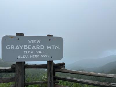 |
|
| Date |
Fri Aug 07, 2026 [3] |
| Meet Place/Time |
09:00 AM, |
| Hike Name |
Camporee 2026 at Appletree Group Campground (3) |
| Description |
Gather with other CMC members August 7-9, for a weekend of fun and fellowship at the Appletree Campground (2425 Junaluska Rd., Topton, NC). We have a large group site reserved with a fire pit, covered pavilion, running water (flush toilets) and a bathhouse (warm showers!). We plan to offer a variety of hikes (and lengths) on Saturday and Sunday along the Bartram Trail (which runs through the campground) and nearby Appalachian Trail. The cost is $10/person to offset the cost of the group site (regardless of how many nights you plan to camp). To reserve your spot, or if you can lead a hike, please contact Jeff Wilcox at 828-989-8755 or jwilcox@unca.edu.
If you'd like to join us but aren't quite up to camping, there are several cabin/Airbnb options in the area, as well as a few hotels in nearby Andrews (about 20 minutes away).
|
| Hike Distance |
0.0 Miles |
| Drive Distance |
0 |
| Elevation Gain |
0 |
| Hike Group |
All-Day Weekend |
| hikenum |
775 |
| Hike Rated |
C-C |
| Hike Type |
TBD |
| Hike Leader |
Jeff Wilcox | jwilcox@unca.edu | 828-989-8755 |
| Challenges |
(none) |
| Wilderness Trail |
No |
| Scout Report |
|
|
| Date |
[CANCELED] Sat Aug 08, 2026 [4] |
| Meet Place/Time |
09:30 AM, Food Lion - 35 Westridge Market Pl. Candler |
| Hike Name |
Buckeye Gap (Rough Butt O/L) - Bearpen Gap (3) |
| Description |
*Canceled due to leader's injury.* Contact leader by email for reservation. Limit of 12 hikers. Hike way up high to escape the August heat. This hike includes deep woods, great views and late summer wildflowers, with a side trip to the end of Charlie's Bald and blueberry picking. There is a section with steep, rocky downhill steps so hiking poles are recommended. Two-mile car shuttle.Topos: Sam Knob |
| Hike Distance |
6.0 Miles |
| Drive Distance |
80 |
| Elevation Gain |
600 |
| Hike Group |
All-Day Weekend |
| hikenum |
369 |
| Hike Rated |
C-C |
| Hike Type |
Car Shuttle |
| Hike Leader |
Marcia Bromberg | mwbromberg@yahoo.com | 860-798-9905 |
| Challenges |
(none) |
| Wilderness Trail |
No |
| Scout Report |
|
|
| Date |
Sun Aug 09, 2026 [5] |
| Meet Place/Time |
08:00 AM, Home Depot off Exit 44 of I-40 |
| Hike Name |
Buckeye Gap Trail and Sunburst (3) |
| Description |
Contact leader by email for reservation. This variation of hike 249 will be a full traverse of the Buckeye Gap Trail with a 2200 foot descent. We'll hike the Buckeye Gap Trail downhill in the Middle Prong Wilderness to the river crossing. We'll cross over the river to the continuation of the Haywood Gap Trail and then hike out to Sunburst. Note: This hike can be tougher than it appears, with a steep downhill and a wet crossing of the Middle Prong. Hiking poles are recommended. Car Shuttle.Topos: Sam Knob |
| Hike Distance |
9.0 Miles |
| Drive Distance |
70 |
| Elevation Gain |
400 |
| Hike Group |
All-Day Weekend |
| hikenum |
249 |
| Hike Rated |
B-C |
| Hike Type |
Loop |
| Hike Leader |
Henry Kassell | hkassell@gmail.com | 845-656-5528 |
| Challenges |
Pisgah 400 |
| Wilderness Trail |
Yes |
| Scout Report |
Cheow and I scouted the tail end of my Sunday hike from Rough Butt OL to Sunburst.
The purpose was to see the water level of the wet crossing, it was shallow, so even with a little rain before the hike it will be an easy crossing. We hiked up FSR 97 to the buckeye trail and the final mile into the Middle Prong. RT 6.3 Miles. |
|
| Date |
Sun Aug 16, 2026 [6] |
| Meet Place/Time |
08:00 AM, Tanger Outlets parking lot behind Waffle House off Exit 33 of I-26 |
| Other Meet Place |
Pisgah Forest Walmart parking (back of center aisles close to Taco Bell) at 08:30 AM |
| Hike Name |
Horsepasture River (3) |
| Description |
Contact leader by email for reservation. Form carpools and meet leader at second meeting place. Come to see the Gorges State Park area. We will hike upstream alongside the Horsepasture River to see the waterfalls Rainbow, Turtleback, Drift and Stairway. This is as good as it gets, all top-rated waterfalls and all entirely different. Several swimming breaks will be taken. This hike is 13 of the 100 Favorite Trails.Topos: Reid |
| Hike Distance |
8.0 Miles |
| Drive Distance |
60 |
| Elevation Gain |
1000 |
| Hike Group |
All-Day Weekend |
| hikenum |
267 |
| Hike Rated |
B-C |
| Hike Type |
In and Out |
| Hike Leader |
Thomas Butler | butler.tom3381@gmail.com | 361-484-3381 |
| Challenges |
Waterfalls (WC100) |
| Wilderness Trail |
No |
| Scout Report |
Hot and humid day with less waterflow in spite of recent rains. I hiked up to Stairway, Rainbow, Turtleback and Drift falls, which is as far as one can go before reaching private property. The trail is moderately steep, with quite a few steps and mud in some places. There is also one fairly wide stream crossing that can be easily rock-hopped. Before returning to the parking lot, I took the Raymond Fisher trail to view the very interesting pond and site of a decommissioned backcountry campsite, then back to the car. Approximately 6 miles, not the 8 posted. |
|
| Date |
Sat Aug 22, 2026 [7] |
| Meet Place/Time |
08:30 AM, Back parking lot of Folk Art Center |
| Hike Name |
Mount Mitchell Loop via Commissary Ridge (3) |
| Description |
Contact leader via email for reservation. We will hike from the Ranger Station at Stepps Gap to the Mt. Mitchell summit via the Old Mitchell Trail, where we'll enjoy the view from the observation platform. Hiking down from the summit, we will take the Mt. Mitchell Trail/MST through moss-covered pine forest and return on the Commissary Ridge Trail. Expect grand views, beautiful forest scenery and (hopefully) flush toilets. This hike is 88 of the 100 Favorite Trails.Topos: Mt. Mitchell |
| Hike Distance |
7.0 Miles |
| Drive Distance |
65 |
| Elevation Gain |
1500 |
| Hike Group |
All-Day Weekend |
| hikenum |
343 |
| Hike Rated |
B-B |
| Hike Type |
Loop |
| Hike Leader |
Judy Magura | quilter290@gmail.com | 828-579-0321 |
| co-Leader |
Jim Magura |
| Challenges |
(none) |
| Wilderness Trail |
No |
| Scout Report |
We, David Angelus, Dianne Bienick, Jim and I, scouted this hike Wednesday July 1. This hike proved to be a good reason for scouting. We decided to reverse the hike by going up Commissary Ridge Trail. This trail is fine. After we had lunch at the top we ventured down via the Mt Mitchell trail. There was a confusing sign that said the trail was closed to Alice Camp. We ventured on but the trail was in horrible condition. One observation was the beautiful fairly new three sets of stairs. The trip ended short just before the restaurant. We took the road the rest of the way to our car at the ranger station. |
|
| Date |
Sun Aug 23, 2026 [8] |
| Meet Place/Time |
08:00 AM, 160 Zillicoa St. (USFS parking lot) off Exit 25 of I-26 |
| Hike Name |
Tanyard Gap to Lovers Leap and Return (3) |
| Description |
Contact leader by email for reservation. Limit of 10 hikers. This hike will be a moderate loop in the Hot Springs area. Starting from Tanyard Gap, we will follow the Appalachian Trail southbound to the intersection with the Lovers Leap Trail and proceed to the old Silvermine Group Camp. Continuing on the Pump Gap Trail, we'll then head back to the A.T. to return to our cars.Topos: Hot Springs |
| Hike Distance |
8.5 Miles |
| Drive Distance |
60 |
| Elevation Gain |
2200 |
| Hike Group |
All-Day Weekend |
| hikenum |
203 |
| Hike Rated |
B-AA |
| Hike Type |
Loop |
| Hike Leader |
Victor Zona | victor.zona@sbcglobal.net | 248-767-2651 |
| Challenges |
(none) |
| Wilderness Trail |
No |
| Scout Report |
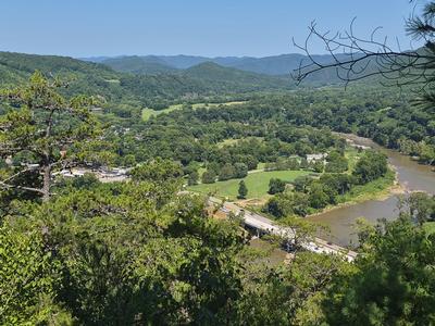
A group of 12 hikers from the Pisgah Hiking group helped me to scout this loop. It's always a good day when you are out in nature, even though the temperature was a bit on the warm side. There was a slight breeze that helped cool us down. The Pump Gap and AT trails are in great shape with a couple of very small stream crossings (rock hops). There are several views from the French Board River side of the AT as your hike toward Lover's Leap. The hike was close to 9 miles with 1,955 feet of elevation gain. Hiking time was 3 hours 40 minutes, total time was 4 hours 30 minutes. |
| Scout Picture |
 |
|
| Date |
Sun Aug 30, 2026 [9] |
| Meet Place/Time |
08:00 AM, Food Lion - 35 Westridge Market Pl. Candler |
| Other Meet Place |
Maggie Valley Post Office at 08:30 AM |
| Hike Name |
Mt. Kephart via Sweat Heifer Creek Trail (3) |
| Description |
Contact the hike leader by email for reservation. Limit of 10 hikers. This hike is designed to visit two of the best scenic overlooks in the Smokies, The Jumpoff and Charlies Bunion, and to climb Mt. Kephart (6217 ft.). From Newfound Gap, we will hike on the A.T. to Mt. Kephart and The Jumpoff, and from there to Charlies Bunion. After lunch, we will return via the A.T., and then down the Sweat Heifer Creek and Kephart Prong Trails. Car shuttle. Note: A parking pass for each vehicle is required in GSMNP. For more info: http://www.nps.gov/grsm/planyourvisit/fees.htm. |
| Hike Distance |
12.8 Miles |
| Drive Distance |
140 |
| Elevation Gain |
2000 |
| Hike Group |
All-Day Weekend |
| hikenum |
241 |
| Hike Rated |
AA-AA |
| Hike Type |
Car Shuttle |
| Hike Leader |
Michael Cornn | mwcornn@gmail.com | 828-458-1281 |
| co-Leader |
Kathy Cornn/Kyle |
| Challenges |
South Beyond 6000 |
| Wilderness Trail |
No |
| Scout Report |
I scouted this hike, along with Tom Butler, on Wednesday, September 19, 2026, which was a cool, beautiful day in the Smokies. I am not sure that I have ever seen a clearer day in the Park during the summer.
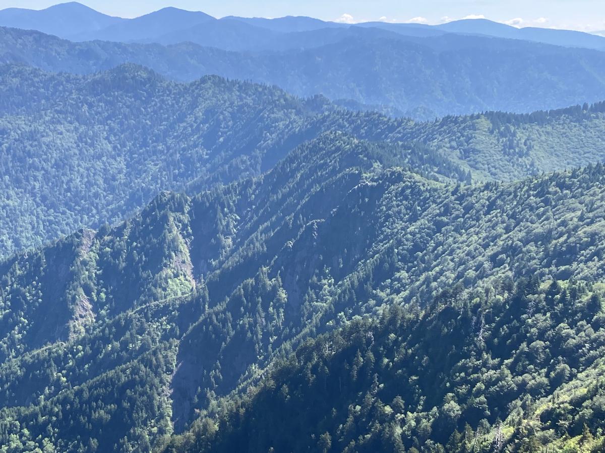
The hike itself consists of two different parts. The first part of the hike utilizes the Appalachian Trail and the Boulevard Trail to access the summit of Mount Kephart (which is more than 6,000 feet high), the Jump Off, and Charlies Bunion (the tourist version). As you can see from the attached photos, the Jump Off and Charlies Bunion provide two of the best views available in the Park. The Appalachian Trail, in particular, is both well-maintained and heavily used, so we can expect a lot of company during this part of our hike.
The second part of the hike, which is almost six miles in length, involves a steady descent from the Appalachian Trail to Highway 441. The initial part of the descent utilizes the Sweat Heifer Trail, which, while in generally good condition, is occasionally overgrown, has a very narrow surface in a few places, and has a few blowdowns. On the Sweat Heifer Trail, one passes a couple of nice small waterfalls, the second of which provides a good place for a rest break. After the Sweat Heifer Trail reaches the Kephart Shelter, we will travel the rest of the way to Highway 441 on the Kephart Prong Trail, which is essentially an old roadbed along the side of scenic Kephart Prong Creek. As the trail nears Highway 441, the hiker passes through the remnants of an old Civilian Conservation Corps camp.
The hike, while a very beautiful one, is long and will take all day to complete. For that reason, you should not expect to be back at your car before late afternoon. In addition, the hike involves a car shuttle. - Jim Ervin
|
| Scout Picture |
 |
|
| Date |
Sat Jul 04, 2026 [10] |
| Meet Place/Time |
08:00 AM, Publix at 165 Weaver Blvd. Weaverville lower end of parking lot off Exit 19 of I-26 |
| Hike Name |
Hump Mountain and Yellow Mountain Area (3) |
| Description |
Hike rescheduled from June 27 due to severe weather on bald. Contact the hike leader by email for reservation. Join us along one of the most scenic areas on the A.T. near Roan Mountain (Roan-Unaka Range), where we will watch for blooming rhododendron, flame azalea and Gray's lily. We will hike from Roaring Creek Road to Yellow Mountain Gap, joining the A.T. along an open ridge to Little Hump Mtn. and Hump Mtn. We will have lunch on a grassy bald at 5587 ft. and return to Yellow Mtn. Gap, then take the Overmountain Victory Loop back to the trailhead. This hike is 99 of the 100 Favorite Trails.Topos: Carvers Gap |
| Hike Distance |
8.4 Miles |
| Drive Distance |
133 |
| Elevation Gain |
2400 |
| Hike Group |
All-Day Weekend |
| hikenum |
475 |
| Hike Rated |
B-AA |
| Hike Type |
In and Out |
| Hike Leader |
Judy Magura | quilter290@gmail.com | 828-579-0321 |
| co-Leader |
Jim Magura |
| Challenges |
(none) |
| Wilderness Trail |
No |
| Scout Report |
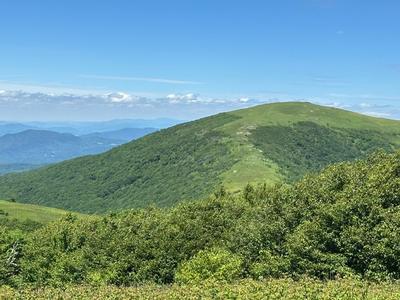
Judy and I had a perfect weather day with full sun and mild temperatures on our scout hike. It did take us 1.5 hours to drive to the trail head, but the outstanding views along the trail on the bald were worth it. The parking area was nearly full when we arrived at the trail head in the early afternoon via the dirt access road, but one spot remained which we quickly occupied. Hiking up through the forest to the bald was fairly easy, but once we arrived at the AT we were treated with outstanding long range views everywhere we looked. The Spring flowers just added to the enjoyment of the day. Judy and I had hiked to the bald and AT several times over the past 15 years and we both quickly agreed why this hike left us with such great memories. We encountered quite a few backpackers and small groups on the trail accompanied by their four footed pet. |
| Scout Picture |
 |
|
| Date |
Sun Jul 05, 2026 [11] |
| Meet Place/Time |
08:30 AM, Back parking lot of Folk Art Center |
| Hike Name |
Mt. Mitchell to Walker Knob via Blackstock Knob (3) |
| Description |
Contact leaders for reservation. Form carpools and meet leaders at Walker Knob at 9:00 am. This is one of the really great sections of the MST and includes two SB6K peaks. The first part of the hike features exceptional views south from the Black Mtns., while the second part showcases the trail-building and rock-work achievements of the CMC. We'll hope to see blooming Turk's cap lilies and see spectacular scenery from our lunch spot on a rocky outcropping. NOTE: Leaders may be camping at Mt. Mitchell Campground, so they will meet the group at Walker Knob at 9:00 am to drop off cars for the car shuttle.Topos: Mt. Mitchell |
| Hike Distance |
9.5 Miles |
| Drive Distance |
70 |
| Elevation Gain |
1600 |
| Hike Group |
All-Day Weekend |
| hikenum |
190 |
| Hike Rated |
A-A |
| Hike Type |
One Way |
| Hike Leader |
Kathy Cornn/Kyle | katherinenkyle@gmail.com | 828-458-1282 |
| co-Leader |
Michael Cornn |
| Challenges |
South Beyond 6000 |
| Wilderness Trail |
No |
| Scout Report |
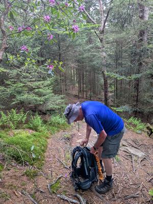
The trail was in good shape when we scouted this hike in June. We did not see any damage from Hurricane Helene on the trail, but we will be going slowly downhill at the beginning because it is rocky. Afterward we will have a rocky uphill so again we will go at a moderate pace because of the rocky terrain. The expansive views, cool high-altitude, fraser firs, red spruces make this an enjoyable hike. We are not camping as described in the write up because the campground is closed for repairs, so we will meet everyone at the Folk Art Center at 8:30. |
| Scout Picture |
 |
|
| Date |
[CANCELED] Sat Jul 11, 2026 [12] |
| Meet Place/Time |
09:00 AM, Tanger Outlets parking lot behind Waffle House off Exit 33 of I-26 |
| Other Meet Place |
BRP Big Ridge Overlook at MM 403.6 at 09:30 AM |
| Hike Name |
Pisgah Inn to Big Ridge Overlook Wildflower Hike on the MST (3) |
| Description |
Contact leader by email for reservation. Limit of 10 hikers. Form carpools and meet the leader at Big Ridge O/L (MM 403.6) at 9:30am to set up the shuttle. Enjoy the mountain views along the MST from Pisgah Inn to the Big Ridge Overlook. After Little Pisgah Mountain, its downhill almost all the way. We will expect to see blooming Turk's cap lilies and black cohosh, among other summer wildflowers. Approximate 5-mile car shuttle.Topos: Dunsmore Mt |
| Hike Distance |
6.0 Miles |
| Drive Distance |
50 |
| Elevation Gain |
1040 |
| Hike Group |
All-Day Weekend |
| hikenum |
531 |
| Hike Rated |
C-B |
| Hike Type |
One Way |
| Hike Leader |
Brenda Worley | bjdworley@gmail.com | 828-606-7297 |
| Challenges |
(none) |
| Wilderness Trail |
No |
| Scout Report |
Adrianne, Judy, and I scouted this hike on a beautiful day. Many wildflowers are blooming, and there is promise of more. There is one steep, short climb on this hike, over the Pisgah Ridge. After that, there is a steep downhill to Elk Pasture Gap. Poles are recommended because of this steep downhill. Then the trail is almost flat to Big Ridge Overlook. We will leave cars at the Big Ridge Overlook and drive to the Pisgah Inn, where we will begin the hike. |
| Scout Picture |
 |
|
| Date |
Sun Jul 12, 2026 [13] |
| Meet Place/Time |
08:00 AM, Tanger Outlets parking lot behind Waffle House off Exit 33 of I-26 |
| Other Meet Place |
BRP Cold Mountain Overlook at MM 412 at 08:30 AM |
| Hike Name |
Flat Laurel Creek, Little Sam Knob, MST Loop (3) |
| Description |
Contact hike leader by email for reservation. Limit of 12 hikers. Form carpools and meet hike leader at second meeting place. This is a pleasant loop trail in the Pisgah Ranger District with views of Sam Knob, Fork Ridge, and Flat Laurel Creek. We'll be hiking in a counterclockwise direction, up the MST with a side trip to Devils Courthouse, down the Little Sam Trail and then a gentle return on the Flat Laurel Creek Trail. At times it feels like youre in an ancient forest. We'll end with a half-mile walk on NC 215 to our cars.Topos: Sam Knob |
| Hike Distance |
7.7 Miles |
| Drive Distance |
60 |
| Elevation Gain |
1000 |
| Hike Group |
All-Day Weekend |
| hikenum |
578 |
| Hike Rated |
B-C |
| Hike Type |
Loop |
| Hike Leader |
Donna Lanning | dblanning@bellsouth.net | 828-606-7956 |
| Challenges |
Waterfalls (WC100) |
| Wilderness Trail |
No |
| Scout Report |
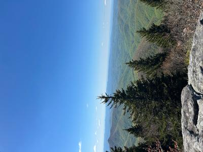
Lorraine and I throughly enjoyed this scout! Ive previously been on that section of the MST and Little Sam, of course, but it had been a long time. The first mile or so is an easy to moderate climb on a rocky trail with lots of roots, definitely have to pay attention. The rest of the hike will be a really nice walk in the woods, a few sunny spots though still mostly in the shade which is appreciated in July. The trail is mostly above 5000 ft. and though probably humid to a degree in the summer, the temps will be lower than in Asheville. The detour to Devils Courthouse (~.7 mi.) off the MST involves a short climb to the lookout, could be crowded with tourists, but still worth it! We noticed a new sign for that intersection, a good thing for those unaware. The MST and Little Sam portions of the trail often feel magical and old as we wander on skinny trails amongst thick laurel and balsam. The Flat Laurel creek trail portion is flat and wider, more populated. It runs by the creek sometimes but when we were there, parts of the creek were very low and appeared dry due to the drought. The walk back to the cars will likely be partially in the sun but not for very long. |
| Scout Picture |
 |
|
| Date |
Sun Jul 19, 2026 [14] |
| Meet Place/Time |
08:30 AM, Back parking lot of Folk Art Center |
| Hike Name |
Big Butt from Walker Knob Overlook (3) |
| Description |
Contact leader for reservation. This moderate in-and-out hike will be at over 5000 feet elevation. We'll take the Big Butt Trail and ascend to Point Misery, Little Butt and then to Big Butt, at just under 6000 ft. The hike goes through a northern hardwood/spruce forest with excellent views of the Black Mountains. We'll hope to see an abundance of blooming Turk's cap lilies and perhaps a few ripe wild blueberries. This hike is 86 of the 100 Favorite Trails. |
| Hike Distance |
6.0 Miles |
| Drive Distance |
45 |
| Elevation Gain |
1650 |
| Hike Group |
All-Day Weekend |
| hikenum |
68 |
| Hike Rated |
C-A |
| Hike Type |
In and Out |
| Hike Leader |
Lorraine Bernhardt | lsbernhardt50@gmail.com | 828-699-8857 |
| Challenges |
(none) |
| Wilderness Trail |
No |
| Scout Report |
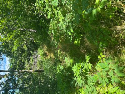
We had an unusually cool and clear day, perfect for hiking. As Donna and I started on the MST, we heard the sound of weed trimmers off in the distance and soon realized that the trails were overgrown and in bad need of maintenance. We waded through the tall grasses and came upon the first two trail maintainers. It was wonderful to pass through the area they had just cut back. We continued on and I was having thoughts of turning around. We came upon another trail maintainer (CMC), and he chatted with us for a bit. I thanked him profusely as this was such a good example of how much we depend upon their volunteer work. We continued on and missed the trail to Big Butt as we were carefully watching our feet. My All trails beeped at me and we found the trail, grown over. This slowed us down substantially.
After lunch at Big Butt, we went down and still found the CMC maintainer hard at work. His goal was to get to the steps. Much to our relief, he said the rest of the way had been finished so our trip back was much easier. Again, without the trail maintainers, hiking would be an exercise in perseverance instead of the enjoyment we take for granted. |
| Scout Picture |
 |
|
| Date |
[CANCELED] Sat Jul 25, 2026 [15] |
| Meet Place/Time |
08:30 AM, Tanger Outlets parking lot behind Waffle House off Exit 33 of I-26 |
| Hike Name |
Sam Knob - Devils Courthouse (3) |
| Description |
Contact leader via email for reservation. This hike in the cool high elevations is perfect for a hot summer day. We will park along the side of FS 816 where the MST crosses and we will hike up to Black Balsam Knob, a SB6K peak, then down to a parking lot and over to Sam Knob. After we ascend Sam Knob with its 360-degree views, we will return via the same trail. We will continue the hike through high meadows on the Flat Laurel and Little Sam Trails. If the timing works out, we can have lunch and dangle our feet in the creek. After lunch, we will take a side trail to Devils Courthouse and then back to the MST. We will return via the MST to FS 816 and our cars. This hike is 53 of the 100 Favorite Trails.Topos: Sam Knob |
| Hike Distance |
8.4 Miles |
| Drive Distance |
60 |
| Elevation Gain |
1800 |
| Hike Group |
All-Day Weekend |
| hikenum |
242 |
| Hike Rated |
B-A |
| Hike Type |
Loop |
| Hike Leader |
Judy Magura | quilter290@gmail.com | 828-579-0321 |
| co-Leader |
Jim Magura |
| Challenges |
South Beyond 6000 |
| Wilderness Trail |
No |
| Scout Report |
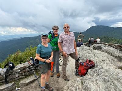
Jim, David, Dianne and I scouted this hike Friday July 17. We started the hike on the MST off FS816 toward Black Balsam, then went down a side trail down to the parking lot and over to Sams Knob. Since we had storms predicted for the afternoon we by passed Sam Knob. We continued on to the Laurel Creek crossing with dry feet. We continued toward Devils Couthouse via Littke Sam Trail. Some of the trail shows erosion from Hurricane Helene and subsequent storms . The trail is doable but we took our time on the wet rocks. We enjoyed great views from Devils Courthouse. Our return to FS816 was met with a lot of overgrowth but we managed to get through it and find our way through the beautiful dark Spruce |
| Scout Picture |
 |
|
| Date |
Sun Sep 06, 2026 [16] |
| Meet Place/Time |
08:00 AM, Back parking lot of Folk Art Center |
| Hike Name |
Graybeard Overlook to Walker Knob Overlook on the MST (3) |
| Description |
Contact leader by email for reservation. This is a modification of hike 464. We will start from Graybeard Overlook and hike on the MST towards Walker Knob Overlook. We will hike through a range of environments and landscapes, including rocky trail sections that require good footwear and hiking poles. We will go through a lovely beech forest and sweeping native grasses, over open blueberry balds with long-range views, and alpine vegetation through old hemlock and lichen-covered oak forest. We will return on the same trail. This hike is 85 of the 100 Favorite Trails.Topos: Montreat |
| Hike Distance |
8.0 Miles |
| Drive Distance |
45 |
| Elevation Gain |
2000 |
| Hike Group |
All-Day Weekend |
| hikenum |
464 |
| Hike Rated |
B-AA |
| Hike Type |
One Way |
| Hike Leader |
Eva Blinder | ejb5711@gmail.com | 828-275-6447 |
| Challenges |
(none) |
| Wilderness Trail |
No |
| Scout Report |
|
|
| Date |
Sat Sep 12, 2026 [17] |
| Meet Place/Time |
09:30 AM, Tanger Outlets parking lot behind Waffle House off Exit 33 of I-26 |
| Other Meet Place |
Pisgah Forest Walmart parking (back of center aisles close to Taco Bell) at 10:00 AM |
| Hike Name |
Moore Cove Falls (3) |
| Description |
Contact leader by email for reservation. This moderate double-loop trail follows two overgrown USFS paths. Expect a lot of scrambling over blowdowns, a couple of short, steep sections and two minor creek crossings. There is one good view of Looking Glass Rock and several waterfalls.Topos: Shining Rock |
| Hike Distance |
7.0 Miles |
| Drive Distance |
65 |
| Elevation Gain |
1050 |
| Hike Group |
All-Day Weekend |
| hikenum |
256 |
| Hike Rated |
B-B |
| Hike Type |
Loop |
| Hike Leader |
Henry Kassell | hkassell@gmail.com | 845-656-5528 |
| Challenges |
Waterfalls (WC100) |
| Wilderness Trail |
No |
| Scout Report |
|
|
| Date |
Sun Sep 13, 2026 [18] |
| Meet Place/Time |
08:00 AM, Food Lion - 35 Westridge Market Pl. Candler |
| Other Meet Place |
Canton Park-n-Ride lot off Exit 33 of I-40 at 08:15 AM |
| Hike Name |
Gabes Mountain Trail (3) |
| Description |
900M Contact leader by email for reservation. Limit of 12 hikers. This hike will follow a mostly gentle trail from the Cosby Campground to Maddron Bald trailhead through open old-growth forest. Added attractions are a short, steep side trip to the bottom of Hen Wallow Falls, lunch at a shady, streamside campsite and a visit to the restored Baxter cabin. Four-mile car shuttle. This hike is in the Smokies and all cars require a parking pass. For more information: http://www.nps.gov/grsm/planyourvisit/fees.htm. |
| Hike Distance |
8.3 Miles |
| Drive Distance |
130 |
| Elevation Gain |
1800 |
| Hike Group |
All-Day Weekend |
| hikenum |
488 |
| Hike Rated |
B-A |
| Hike Type |
Car Shuttle |
| Hike Leader |
Karen Lachow | heyk127@hotmail.com | 703-395-5879 |
| Challenges |
(none) |
| Wilderness Trail |
No |
| Scout Report |
|
|
| Date |
Sun Sep 20, 2026 [19] |
| Meet Place/Time |
08:30 AM, Food Lion - 35 Westridge Market Pl. Candler |
| Hike Name |
Smokemont Loop (3) |
| Description |
900M Contact leader for reservation. We will hike the Smokemont Loop Trail in the Great Smoky Mountains National Park. We will go clockwise, starting in the Smokemont Campground and climbing steadily up Richland Mountain before descending to Bradley Fork. The Bradley Fork Trail follows the water along an old roadbed. We will take an in-and-out detour up the Chasteen Creek Trail to the cascade before returning and continuing down the Bradley Fork Trail to the cars at Smokemont. This hike is 28 of the 100 Favorite Trails. This hike is in the Smokies and all cars require a parking pass. For more information: http://www.nps.gov/grsm/planyourvisit/fees.htm.Topos: Smokemont |
| Hike Distance |
8.0 Miles |
| Drive Distance |
110 |
| Elevation Gain |
1300 |
| Hike Group |
All-Day Weekend |
| hikenum |
642 |
| Hike Rated |
B-B |
| Hike Type |
Loop |
| Hike Leader |
Danny Bernstein | dannyhiker@gmail.com | 828-450-0747 |
| Challenges |
(none) |
| Wilderness Trail |
No |
| Scout Report |
The Smokemont loop in Great Smoky Mountains National Park is a classic. It has a cemetery, lots of water including Bradley Fork and a waterfall at Chasteen Creek.
Well have a snack at the top of the hill and lunch at the waterfall.
The last part of the hike takes us across a bridge and up Chasteen Creek Trail where we may see horses.
Come on out.
|
| Scout Picture |
 |
|
| Date |
Sat Sep 26, 2026 [20] |
| Meet Place/Time |
08:30 AM, Back parking lot of Folk Art Center |
| Hike Name |
NC 128 to Walker Knob Overlook on the MST (3) |
| Description |
Contact leader by email for reservation. This hike in the high country on the Mountains-to-Sea-Trail near Mount Mitchell features great views, rocky climbs, spruce forests and 6320-ft. Blackstock Knob. The hike has difficult downhills, and challenging footwork due to storm damage, but there are wide-open views that are new. If the weather is in our favor, we will first drive to the Mt. Mitchell summit parking and do the steep, paved quarter-mile hike to the observation deck for 360-degree views. Car shuttle.Topos: Montreat |
| Hike Distance |
5.0 Miles |
| Drive Distance |
60 |
| Elevation Gain |
1500 |
| Hike Group |
All-Day Weekend |
| hikenum |
2 |
| Hike Rated |
C-B |
| Hike Type |
One Way |
| Hike Leader |
Becky Smucker | bjsmucker@gmail.com | 828-231-2198 |
| Challenges |
AT-MST,South Beyond 6000,Waterfalls (WC100) |
| Wilderness Trail |
No |
| Scout Report |
|
|
| Date |
Sun Sep 27, 2026 [21] |
| Meet Place/Time |
08:00 AM, Food Lion - 35 Westridge Market Pl. Candler |
| Other Meet Place |
Haywood County Rest Area 19500 Great Smoky Mtn. Expy. (US 23/74) Waynesville NC at 08:30 AM |
| Hike Name |
Waterrock Knob to The Pinnacle (3) |
| Description |
Contact leader by email for reservation. This hike will begin from the Waterrock Knob lower parking lot and continue along a rough trail, passing Yellow Face and mega rock formations, and on to the spectacular view from Blackrock Mtn. From there we will descend a bit and then hike out to even more spectacular views of craggy Pinnacle Park. We will then backtrack a short distance before descending steeply to our vehicles at the Fisher Creek trailhead. 30-minute car shuttle. |
| Hike Distance |
9.0 Miles |
| Drive Distance |
90 |
| Elevation Gain |
1500 |
| Hike Group |
All-Day Weekend |
| hikenum |
938 |
| Hike Rated |
B-B |
| Hike Type |
Car Shuttle |
| Hike Leader |
Mike Knies | knies06@att.net | |
| Challenges |
South Beyond 6000 |
| Wilderness Trail |
No |
| Scout Report |
|
|